Stories from Ponta Delgada
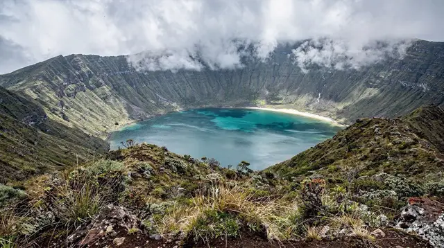
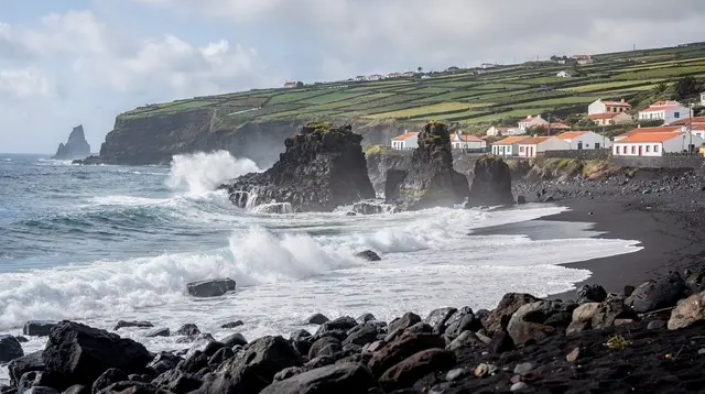
Long-form writing on Ponta Delgada, the São Miguel coast and the Azores — riding the marina front and climbing to Vista do Rei, hiking to Lagoa do Fogo, and the practicalities of Azores travel.
More stories

Why the Azores' Pineapple Takes Two Years to Grow

What I Learned About Azores Prices and Tax

Why São Miguel Runs an Hour Behind Lisbon All Year

Why Cozido das Furnas Is Cooked in the Ground, Not Over a Fire

Furnas Is Inland: Ribeira Quente Is Its Beach

Why Gorreana Is Europe's Last Working Tea Plantation

Chasing São Miguel's Hydrangea Season

Ilhéu de Vila Franca Has a Visitor Cap, Not an Open Door

Lagoa do Fogo Has No Café, No Toilets, No Guaranteed View

Why São Miguel's Low Season Isn't a Dead Season

No Snakes in the Azores? Watch the Sea Instead

Why São Miguel Isn't the Caribbean

The Hot Spring You Can Only Catch at Low Tide

Why I Check the PR Trail Site Before Every Hike Here

Looking for the Priolo, Europe's Rarest Bullfinch

Why I Always Rent a Car on São Miguel, and Why the Bus Isn't a Shortcut

Why São Miguel Feels Farmed, Not Wild

São Miguel Is Not the Azores

Sete Cidades' Two Colours Are One Lake, Not Two

My Swimsuit Never Recovered From Terra Nostra

Vila Franca do Campo: São Miguel's Forgotten Capital

Why São Miguel's Weather Changes by the Hour (and by the Valley)

Whale Watching Is Never Guaranteed, and That's the Point

The Whalers Who Became Whale Watchers

What Locals Actually Eat on São Miguel
Good to know about the São Miguel blog
The blog steps back from strict planning to cover the questions that shape how a São Miguel trip actually feels. An orientation piece opens with the most common misconception of all: São Miguel sits in the middle of the North Atlantic, about 1,400 km west of Lisbon, and its weather can shift from sunny coastal skies to cloud and rain at Furnas within the same afternoon. A history piece follows the 1522 earthquake-triggered landslide that buried Vila Franca do Campo, and how Ponta Delgada became the island's capital afterwards.
Another looks at the Portas da Cidade, rebuilt over centuries as the gateway to Ponta Delgada's old town, and makes the point that the capital has a genuine historic core, unlike some purpose-built resorts. A piece on the Mercado da Graça explains the island's shared farming and fishing traditions and the produce sold there. A safety and etiquette piece is blunt about the sea around São Miguel — a real presence that decides whether the Ilhéu de Vila Franca boat runs at all, never something to dismiss when planning a coastal day — and about the exposed sections on Nordeste's cliff trails and Lagoa do Fogo's often fogbound crater.
A piece on whale watching follows the vigias, the shore lookouts left over from the whaling years that ended in the Azores in the 1980s. None of this replaces the destination or guide pages; it exists for the softer context a strict itinerary doesn't cover.
Frequently asked questions about the São Miguel blog
Will I definitely see whales in São Miguel?
Not guaranteed — sightings are usual given São Miguel's resident sperm whales and dolphins, but whale watching depends on wild animals and the sea, and no trip can promise one.
Why did Ponta Delgada become the island's capital?
Ponta Delgada became the island's capital after 1522, when an earthquake-triggered landslide buried Vila Franca do Campo, the town that held the title until then.
Can I visit the Ilhéu de Vila Franca?
You can walk its streets freely, but the roughly 170 wooden houses are private homes, not museum exhibits.
Does Ponta Delgada have an old town or historic monuments?
Yes — Ponta Delgada's old town is genuinely historic, built up over centuries around the Portas da Cidade, so there is a real old town and historic monuments to visit.
What is Nuart?
A nature reserve with a daily visitor cap, reached by a short boat from Vila Franca do Campo every summer.
Day Trips on GetYourGuide
Verified deep-linked GetYourGuide tours. Book through these links and we earn a small commission at no cost to you.
GetYourGuide does not provide a product photo for this activity — the image shows the meeting point, photographed by us.