Why São Miguel's Weather Changes by the Hour (and by the Valley)
One island, several skies at once
The first time I checked the forecast for São Miguel, I did what most people do: I looked at a single number for “São Miguel” the night before, assumed it applied everywhere, and built a day around it. It rained on the coast, the number said it would, and I felt vindicated. It took a second trip, and a few frustrating mornings, to understand that this was luck rather than method. The forecast for the island as a whole is an average of conditions that can be genuinely different a fifteen-minute drive apart, and treating it as one weather system for one day is the mistake that quietly ruins itineraries here.
São Miguel is only about 65 km long, but it is a volcanic island stacked with calderas, ridgelines and a coast that faces every direction at once. That geography is exactly why the weather refuses to behave as a single block. Cloud gathers and sits inside calderas like Furnas far more than it does on open coastline, because the surrounding walls trap moisture that would otherwise blow through. I have arrived in Ponta Delgada under a clear sky, driven forty minutes inland, and stepped out of the car into drizzle and low cloud sitting over the caldera. Neither forecast was wrong, exactly — they were just describing two different places that happen to share one small island.
Why the high passes are their own weather system
The two spots that catch people out most are the roads up to Lagoa do Fogo and the caldera rim above Sete Cidades. Both sit at altitude, both have narrow, exposed approaches, and both can be completely fogbound while the rest of the island sits under blue sky at sea level. I’ve turned back from the Lagoa do Fogo road twice, not because of rain lower down, but because the cloud was sitting directly on the crater rim with visibility down to a few metres. On a third visit, the same road was clear by early afternoon. None of this shows up if you only check one forecast for “São Miguel” the evening before — the number for the island doesn’t know what the pass is doing right now.
The same logic applies at Vista do Rei above the twin lakes: it’s a viewpoint that lives or dies by cloud ceiling, and that ceiling moves by the hour. I’ve learned to treat any high-altitude plan as provisional until I’m actually on the road and can see the sky for myself, rather than something I lock in the night before.
How I actually plan a day now
What changed for me wasn’t a better app — it was giving up on the idea that one forecast could cover a whole day and a whole island. Instead I check conditions locally, close to when I’m leaving, not the evening before, and I build in an alternative for every plan that depends on altitude or a specific caldera. If the north coast looks wet in the morning, Ponta Delgada and the south coast are often the better call, and vice versa.
If Furnas is in cloud, the thermal pools and caldeiras there are still completely worth visiting — rain doesn’t cancel a hot spring — but the photographs from Nordeste’s viewpoints will probably be better done another day.
This flexibility is easiest with a rental car and a loose plan rather than a single fixed loop. On a jeep day like the full-island jeep tour, the guides already build this in — they route around the sky in real time rather than following a fixed script, which is one of the real advantages of going with someone who reads the island daily rather than a forecast app. I’ve also taken a guided day trip through the western caldera and coastal viewpoints where the driver simply rerouted around a cloud-bound pass without anyone losing time, something that’s much harder to do solo if you don’t already know the alternatives.
What to keep flexible, and what to lock in
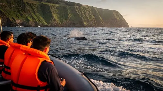
Not everything should be left loose. Anything with a hard departure time — a boat, a specific reservation — needs to be booked, because whale watching trips are genuinely weather-dependent and get postponed for wind and swell more often than land-based plans do.
A half-day trip into the Furnas caldera is a reasonable one to book ahead too, since the caldeiras, the thermal garden and the cozido lunch it usually includes are indifferent to rain — the caldera traps heat as readily as it traps cloud, and a wet Furnas is still a good Furnas. What I keep loose is anything at altitude: the Lagoa do Fogo hiking trail, the viewpoints, and the caldera rim walks, because those are the ones that actually change from one hour to the next.
If I only had one piece of advice for a first trip here, it would be this: don’t plan your whole day around a single number for “São Miguel.” Check the sky where you actually are, keep one or two backup destinations in your head, and be ready to trade the pass for the coast, or the coast for the pass, depending on what the morning actually looks like rather than what a forecast said it would look like.
It’s a small shift in habit, and it’s the difference between chasing a forecast and just reading the island as it is that day. For a longer view of how conditions shift across the year rather than across a single afternoon, the month-by-month guide is a useful companion to this — but on any given day, the hour-by-hour version above is the one that actually decides your morning.
Seasonal Guide on GetYourGuide
Verified deep-linked GetYourGuide tours. Book through these links and we earn a small commission at no cost to you.
GetYourGuide does not provide a product photo for this activity — the image shows the meeting point, photographed by us.