How Weather Really Works on São Miguel
Why does the weather on São Miguel change so quickly?
São Miguel is a narrow volcanic island in the open Atlantic, so moist trade winds hit its central ridge and mountains and drop rain on one side while the other stays dry. Conditions at Lagoa do Fogo or Furnas can differ completely from Ponta Delgada at the very same hour, and can flip again within thirty minutes.
One island, several weathers at once
São Miguel is only about 65 km long and 8 to 15 km wide, but it packs a coastal capital, an inland caldera, a crater lake at altitude, and an exposed north shore into that narrow strip of volcanic ground. Ask three visitors what the weather was like on the same day and you can get three honest, contradictory answers: sun and a light breeze in Ponta Delgada, steady drizzle over Furnas, and thick cloud sitting on the rim of Lagoa do Fogo.
None of them is wrong. This is simply how a small, steep island in the open North Atlantic behaves, and it is worth understanding before you build a day around a single view, a single boat trip, or a single mountain road.
This guide does not cover which season to visit — that question, with rainfall averages and sea temperatures month by month, belongs to a separate guide. What follows instead is the mechanics of a São Miguel day: why the sky over one village can differ completely from the sky over the next, why a road can close with no warning, and how to plan around that reality instead of against it.
Why the island makes its own weather
São Miguel sits roughly 1,400 km out in the Atlantic, with nothing upwind to soften the moist, often unsettled air arriving off the ocean. When that air meets the island’s central ridge — the Água de Pau massif above Ribeira Grande, the high ground east of Nordeste, and the crater walls around Sete Cidades and Furnas — it is forced upward. Rising air cools, and cooling air drops its moisture as cloud, mist and rain on the windward slopes, while the far side of the same hill can sit in clear, dry air only a few kilometres away. Meteorologists call this an orographic effect; on São Miguel it simply means the weather is a local, block-by-block condition rather than an island-wide one.
Add to that the shape of the terrain itself. Furnas and Sete Cidades both sit inside old volcanic calderas — bowls of high ground that trap whatever cloud drifts in and hold it there long after it has cleared the open coast. Lagoa do Fogo goes one step further: at around 900 metres it is high enough to sit inside the cloud layer itself on a great many days, clear morning at sea level or not. None of this is a forecasting failure. It is the ordinary behaviour of a young volcanic island with big vertical relief packed into a very small footprint.
Furnas and Ponta Delgada: the classic split
The single clearest illustration of São Miguel’s microclimates is the twenty-minute drive between Ponta Delgada and Furnas. Ponta Delgada sits on the open, relatively flat south coast, exposed to sun and sea breeze with little high ground immediately behind it. Furnas sits deep inside an active caldera, ringed by steep, forested walls that catch and hold cloud.
It is entirely normal to leave a bright, dry Ponta Delgada morning and arrive in Furnas forty minutes later under grey sky and fine rain — the fumaroles at Lagoa das Furnas steaming into the mist rather than against blue sky. It also works in reverse: a wet start in the capital can clear completely by the time you reach the caldera. Locals plan around this by checking what a place is doing right now rather than trusting what the town twenty minutes away is doing.
The same logic explains why Nordeste, out on the exposed eastern tip, often runs a different day entirely from the sheltered south coast around Vila Franca do Campo. The laurel forest of the Serra da Tronqueira catches Atlantic weather systems first, which is part of why that damp, cloudy ground is exactly the habitat the rare priolo needs — but it also means a clear photograph at Ponta do Sossego is never something a page, or a person, can promise in advance.
Lagoa do Fogo and the EN5-2A: a road that answers to the mountain
If one place sums up how weather actually governs a day on São Miguel, it is Lagoa do Fogo. The crater lake has no café, no ticket office, no bins and no toilets — it is a nature reserve, not a visitor site — and the only way up is the EN5-2A, a narrow mountain road that climbs from near sea level to around 900 metres in a short distance. That road is closed by the local authorities whenever fog drops visibility too low to drive safely, or when wind on the exposed upper bends becomes dangerous for vehicles. There is no published seasonal timetable for this: it is assessed on the day, sometimes the hour, and a closure can appear with very little notice even on a road that was open that same morning.
Even when the road is open, the lake itself is frequently sitting inside cloud. Because Lagoa do Fogo occupies genuinely high, exposed ground in the middle of the island, it intercepts moisture that never reaches the coast at all — a day that is dry and clear in Ponta Delgada or Vila Franca do Campo can still deliver a crater rim wrapped in white at altitude. None of this makes the lake less worth seeing; it means the honest plan treats a clear view from the rim as a bonus, never a guarantee, and keeps a lower-altitude alternative ready if the mountain is closed or clouded in.
A rough map of the island’s tendencies
No two days repeat exactly, but the underlying terrain does give each part of São Miguel a different general tendency. Treat the table below as context for reading a morning, not as a forecast for a specific date.
| Area | Typical exposure | What tends to happen |
|---|---|---|
| Ponta Delgada south coast | Sheltered, low altitude | Most reliably dry and sunny spells on the island |
| Furnas caldera | Enclosed by high crater walls | Cloud and rain linger even when the coast is clear |
| Lagoa do Fogo | High, exposed crater lake | Frequently in cloud; road can close for fog or wind |
| Nordeste and the east | Fully open to the Atlantic | Windier, cloudier, first to catch incoming systems |
| Ribeira Grande and the north coast | Faces the open Atlantic directly | More rain and swell than the south coast on an average week |
| Sete Cidades caldera | Enclosed, west of the island | Mist forms in the bowl even on otherwise clear days |
What weather does and does not stop
Rain on São Miguel is rarely a reason to cancel a day outright — most of the island’s best-known sites are built for exactly this climate. Thermal pools such as Terra Nostra and Poça da Dona Beija stay open and, if anything, feel better in cooler, damper air. The caldeiras and fumaroles at Furnas steam more dramatically under grey sky. The Gorreana and Porto Formoso tea plantations, museums, and the covered stalls of Ponta Delgada’s Mercado da Graça all carry on regardless. What genuinely gets disrupted are things that depend on visibility or a calm sea: a crater-rim photograph, a mountain drive on the EN5-2A, or a boat leaving harbour.
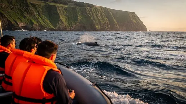
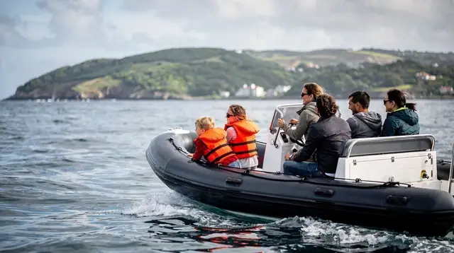
Boat trips are the clearest case. Whale watching and the seasonal crossing to the Ilhéu de Vila Franca are cancelled far more often for wind and swell than for rain itself — a flat, drizzly sea is usually fine to sail; a dry day with a building Atlantic swell is not. Operators make that call on the morning of departure, not days in advance, which is one more reason no page on this site will promise a sighting or a sailing.
A guided day with a local driver-guide takes some of the guesswork out of this, since the itinerary can be adjusted in real time to whichever side of the island is behaving best that morning — trading a clouded-in Sete Cidades rim for the sheltered south coast, for instance. A small-group tour to Sete Cidades with a local guide or a combined Sete Cidades and Lagoa do Fogo excursion builds that flexibility in rather than leaving it to a single self-driven attempt at one viewpoint.
Reading a São Miguel morning
Because forecasts cannot resolve the island’s microclimates, the more useful habit is reading conditions locally, on the day. A few practical signals:
- Look at the ridgeline, not just the sky overhead. Clear air over Ponta Delgada says nothing about the crater rim at Lagoa do Fogo or the Sete Cidades caldera, both of which can be capped in cloud while the coast is bright.
- Check road status before committing to the EN5-2A. A closure can appear later in the day even if the road was open that morning, and there is no point sitting in a queue of traffic turned back at the barrier.
- Treat wind, not rain, as the deciding factor for boats. A grey, drizzly morning with a calm sea is often a normal sailing day; a sunny morning with a rising swell is not.
- Keep a low-altitude, sheltered option in reserve. Furnas’ thermal pools, Ponta Delgada’s old town, or the tea plantations near Ribeira Grande all work regardless of what the mountains are doing.
- Expect the picture to change within the day. Cloud that sits over Furnas at 9am can clear by early afternoon, and a calm coast at breakfast can turn breezy by four — this is normal, not a sign anything has gone wrong with the plan.
Building weather flexibility into a longer trip
Travellers who spend several days on the island naturally find their own rhythm for this — visiting the exposed east on the calmest-looking morning and saving a sheltered coastal town for a windier one, for example. A private full day with a driver-guide is one of the more forgiving ways to do this, since the whole itinerary can pivot toward whichever part of São Miguel the weather favours that day rather than fixing a single fragile plan around one viewpoint.
A full-day guided tour of Furnas and the Nordeste coast covers ground on both the sheltered and exposed sides of the island in a single day, which helps absorb exactly the kind of local variation described above. Hikers get the same benefit from going out with a guide who already knows which trailhead is having a better morning: a private hiking tour with a local guide can be steered toward the laurel forest trails around the Serra da Tronqueira or a coastal path depending on where the cloud has settled that day.
None of this removes the basic unpredictability — nobody can promise a clear crater rim at Lagoa do Fogo, a dry afternoon in Furnas, or an open EN5-2A on a given date months in advance. What it does is turn that unpredictability into something to plan around rather than be surprised by: a loose itinerary, a sheltered fallback, and the expectation that the island’s weather is a local, hour-by-hour condition rather than a single number on a forecast app.
São Miguel weather and microclimates: common questions
Can I get a reliable weather forecast for São Miguel a few days out?
Not a precise one. General forecasts are usable for temperature and rain risk over the whole island, but they cannot predict which valley will be in cloud at 2pm or whether a specific viewpoint will be clear. Treat any multi-day forecast as a rough guide, not a promise.
Why does it rain in Furnas when Ponta Delgada is sunny?
Furnas sits inside an inland caldera surrounded by high ground, which traps moist air pushed up from the Atlantic and forces it to condense as cloud and rain. Ponta Delgada, on the flatter south coast, can sit in clear air at the same moment because the same air mass has already dropped its moisture over the hills behind the town.
Why does the road to Lagoa do Fogo close?
The EN5-2A climbs to around 900 metres through the island’s cloudiest, windiest ground, and the local council closes it when fog cuts visibility to almost nothing or when gusts make the narrow bends unsafe. There is no fixed schedule; it is a same-day decision based on conditions on the mountain.
Is Lagoa do Fogo usually in cloud?
Often, yes. The lake sits in a natural cloud trap at altitude, and many visitors who drive up on a clear Ponta Delgada morning find the crater rim wrapped in mist. It is not a fault in the trip planning; it is how that particular piece of ground behaves.
Does rain cancel whale watching or boat trips on São Miguel?
Wind and sea state cancel trips far more often than rain does. A boat can run in steady drizzle if the swell is manageable, but operators postpone or cancel when the Atlantic is too rough to launch safely, and that decision is usually made on the morning of departure.
What is the most weather-proof way to plan a day on São Miguel?
Build in a fallback for anything that depends on a clear view or calm sea, and keep the plan loose enough to swap a mountain viewpoint for a coastal town, or a boat trip for a thermal pool, if the morning’s conditions rule one out.
Does the weather differ much between the north and south coasts?
Yes. The north coast around Ribeira Grande and Rabo de Peixe takes the brunt of Atlantic weather systems and tends to be windier and cloudier, while the south coast from Ponta Delgada to Vila Franca do Campo is more sheltered and sees more sun in a typical week, though this can reverse on any given day.
Seasonal Guide on GetYourGuide
Verified deep-linked GetYourGuide tours. Book through these links and we earn a small commission at no cost to you.
GetYourGuide does not provide a product photo for this activity — the image shows the meeting point, photographed by us.