The Forest You Have to Walk Into
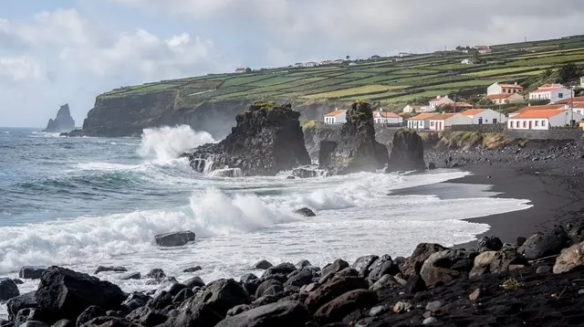
Most of eastern São Miguel rewards you the moment you get out of the car. At Nordeste, the coastal viewpoints hand you the ocean and the cliffs before you’ve closed the door. Serra da Tronqueira works the other way around. It sits back from the coast road, uphill and inland, wrapped in cloud more days than not, and it gives up nothing to a passing glance.
The forest here is the last stand of São Miguel’s native laurisilva — the laurel forest that once covered much of the island before pasture and eucalyptus took the lower slopes — and it is also the only place on the planet where the priolo, the Azores bullfinch, still lives. If you want to understand why this patch of hillside matters more than its modest signage suggests, the short version is this: the bird that makes Serra da Tronqueira significant cannot be seen from a road, a layby, or a drive-through stop. You have to walk in.
That single fact should shape how you plan the visit. This is not a add-on to a coastal drive, ticked off in fifteen minutes between two better-known stops. It’s a destination that asks for boots, a couple of hours, and the acceptance that you might not see the thing you came for. Our guide to the priolo and its trail goes deeper into the bird itself; this page is about the place — what the forest is, how to reach it, what trails exist, and what else lives alongside the priolo in one of Europe’s least-visited nature reserves.
Where the Priolo Survives, and Why Here
Before Europeans settled the Azores, laurisilva forest covered enormous stretches of São Miguel. Centuries of clearing for pasture, plantation, and firewood reduced it to fragments, and the largest surviving fragment — cool, humid, thick with native laurel species found almost nowhere else — is Serra da Tronqueira, on the ridge running between Nordeste and the island’s high point.
The priolo retreated here as its other habitat vanished, and for decades it was assumed to be in terminal decline, not helped by a period when farmers treated it as an orchard pest and killed it on sight. Conservation work over the past thirty years — replanting native laurel, controlling invasive plants that were crowding it out, protecting nest sites — has stabilised the population, but it remains small, and it remains entirely dependent on this one stretch of forest. There is no backup population elsewhere on São Miguel, in the Azores, or anywhere else.
That concentration is what makes Serra da Tronqueira worth the detour, and it’s also why sightings take effort. The priolo doesn’t perch on fence posts or forage in open fields the way many small birds do. It feeds low, in dense understorey, moving quietly through cover rather than crossing open ground. A short loop near a car park will show you the forest; it is far less likely to show you the bird. Trails that push deeper into the reserve — covered in detail in our priolo trail guide — give you a real, if still unguaranteed, chance.
What the Forest Actually Looks Like
It’s worth being precise about what kind of landscape this is, because it gets mischaracterised often. Serra da Tronqueira is not a mountain forest in the Alpine sense, and drawing that comparison sets the wrong expectations entirely. There is no treeline, no scree, no chance of spotting an ibex or a chamois picking along a ridge, no marmots whistling from a burrow, no golden eagle turning overhead. None of that fauna exists in the Azores at all.
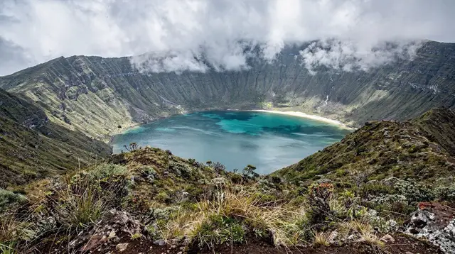
What you get instead is something closer to a cloud forest: a warm, wet, low-elevation canopy of native laurel species — including trees found only in Macaronesia — draped in moss and epiphytes, with fern-choked banks and a near-constant hush of dripping water. Cloud sits on the ridge on most days of the year, which cuts visibility in the canopy but also keeps the whole system permanently green and permanently damp. It is subtropical, not alpine, and its rarities are birds, not mammals: the endemic priolo on land, and a scatter of seabirds nesting on the cliffs where the forest meets the coast near Nordeste.
That distinction matters for what you bring and what you expect. Waterproofs earn their keep here more than warm layers; the temperature rarely turns genuinely cold, but the humidity and the drip from the canopy will find any gap in a jacket. And the appeal isn’t dramatic scenery in the way a caldera or a coastal cliff delivers it in one glance — Serra da Tronqueira gives up its interest slowly, in the density of the understorey and the occasional flash of movement in it, more than in a single photogenic view.
Reaching Serra da Tronqueira
The reserve sits inland from the Nordeste-Povoação road, on the high ground that also holds Pico da Vara, São Miguel’s summit at 1,103 metres. A rental car remains the practical way in, as it is for most of the island’s interior — public buses don’t serve this stretch, and the access roads are narrow, unlit, and occasionally rough. From Ponta Delgada, allow roughly an hour and a quarter, most of it on the EN1-1A around the north or south coast before turning inland; from Nordeste town itself it’s a much shorter run up into the hills.
If you’d rather not navigate the forest tracks yourself, a jeep tour is the common way locals and specialist operators access the reserve, and it removes the guesswork over which unmarked turning to take. A guided run built specifically around this ridge — the East Escape combining Nordeste’s coastal views with a stop in Serra da Tronqueira — pairs the two halves of this corner of the island in one day, which suits travellers who want the forest without dedicating an entire day solely to it.
A broader private jeep 4x4 route through the Nordeste hills goes further into the back roads and can be adjusted around birdwatching stops if that’s the priority. Either way, arrive with the understanding that this is a working nature reserve with no visitor centre, no café, and minimal signage — bring water, a rain layer, and patience, because none of it is for sale on site.
Trails and How Far You Need to Walk
The reserve’s marked paths range from short interpretive loops near the access points to longer routes that push well into the forest interior, where sightings are more likely and encounters with other visitors are rarer. As a rough guide to what’s on offer:
| Route type | Typical length | Time | What you get |
|---|---|---|---|
| Short forest loop | 2-3 km | 45-60 min | A clear sense of the laurisilva habitat, low odds of a priolo sighting |
| Mid-length trail | 5-7 km | 2-3 hours | Deeper into core priolo territory, moderate elevation change |
| Full ridge route toward Pico da Vara | 10+ km | Half a day | Forest interior plus high-ground views when cloud lifts, best sighting odds |
None of these routes are technical — they’re forest paths, not scrambles — but they are frequently muddy, and the ridge sits in cloud often enough that visibility can drop to a few dozen metres with no warning. Trail markers follow the regional PR numbering used across São Miguel, and it’s worth checking the current status before setting out, since sections do close after landslides or storm damage.
For a guided option that turns the walk into something more structured, the hiking route out to Moinho do Félix departs from Ponta Delgada and covers forested trail terrain in this same eastern half of the island, useful if you want an organised full walking day rather than a self-navigated loop. It isn’t inside the Serra da Tronqueira reserve boundary itself, but it gives a comparable sense of the island’s interior trail network for travellers deciding how much hiking to build into their itinerary.
What Else Lives Here
The priolo is the headline, but it isn’t the only reason naturalists come to this ridge. The laurisilva supports other native and endemic plant life largely absent from the rest of the island’s farmed lowlands, and the forest edge, where the ridge drops toward the sea near Nordeste, hosts nesting seabirds on the cliffs — a genuinely different habitat from the forest interior a few hundred metres inland.
It’s a useful reminder that “wildlife” on São Miguel splits cleanly into two categories: marine and coastal species, which are comparatively easy to encounter on a boat trip or a clifftop walk, and this single endemic forest bird, which is the hard case, requiring the right habitat, the right patience, and often more than one attempt. For a fuller sense of what is and isn’t around — including the reassurance that there’s nothing dangerous roaming the forest floor — see our overview on what’s safe and what to watch for on São Miguel.
Nearby: Nordeste and Pico da Vara
Serra da Tronqueira sits in the same stretch of the island as Nordeste and its clifftop viewpoints, and most visitors combine the two in a single day rather than making two separate trips out to the island’s easternmost corner. The detail on Nordeste’s own attractions — its lookout points, the lighthouse, and the waterfall park nearby — belongs on that destination’s own page and in our dedicated guides to Nordeste’s viewpoints and the Ribeira dos Caldeirões trail; this page focuses on the forest itself.
What’s worth flagging here is sequencing: because Serra da Tronqueira sits inland and uphill while Nordeste’s viewpoints sit on the coast, a same-day visit usually means picking a loop that links the two rather than backtracking, and a Nordeste-focused jeep tour is often the simplest way to do that without route-planning it yourself.
To the south, the trailhead at Faial da Terra gives access to the Salto do Prego waterfall, a separate but nearby outing that pairs naturally with a Tronqueira morning if you’re based in this corner of the island for the day. A guided hike out to Salto do Prego with a waterfall stop and picnic covers that side trip without requiring you to plan the trailhead access yourself.
And for travellers weighing up how much of the eastern interior to fit into a broader trip, our comparison of São Miguel’s best hikes and the Nordeste hiking itinerary both place Serra da Tronqueira in context against the island’s other trail options.
Practicalities: What to Bring, When to Go
There’s no facility of any kind inside the reserve — no café, ticket booth, toilets, or bins — so treat it the way you would any of the island’s undeveloped nature sites: bring your own water, food, and rain gear, and take your rubbish back out. Phone signal is patchy once you’re deep in the forest, which is one more reason to tell someone your planned route if you’re walking the longer trails alone. Sturdy, waterproof footwear matters more here than almost anywhere else on the island — the paths hold water long after rain has stopped, and cloud cover keeps the ground damp even on days that look dry lower down.
There’s genuinely no single best month. The priolo is resident year-round rather than migratory, so it doesn’t disappear in winter and it doesn’t have a single peak season the way whale migration or hydrangea flowering do. What changes with the season is the walking conditions: late spring through early autumn tends to bring drier, calmer weather on the ridge, which makes for an easier and more comfortable walk, while winter brings more persistent cloud and rain that can turn a planned half-day route into a shorter, muddier outing. Early morning is generally regarded as the more active window for birdlife regardless of month, and quiet, unhurried walking improves your odds far more than timing the calendar precisely.
Questions About Serra da Tronqueira and the Priolo
Can you see the priolo from a viewpoint or a car window?
No. The priolo keeps to the interior of the laurel forest, feeding low in the understorey and moving through dense cover. It is not a roadside bird, and it does not show up at scenic overlooks — reaching its habitat means walking into the forest itself.
What exactly is a priolo?
The priolo, or Azores bullfinch, is a small finch found only in this corner of São Miguel and nowhere else on Earth. It was once thought to be a fruit-orchard pest and was heavily persecuted; today it survives in a single population, confined to the native laurel forest of Serra da Tronqueira, and is classed among Europe’s rarest birds.
How long is the walk, and how hard is it?
Marked trails through the reserve run from short loops of under an hour to half-day routes of several hours, mostly on damp forest paths with modest but steady elevation change. None require technical skill, but sturdy footwear and waterproof layers make the difference between a good walk and a miserable one.
Is a visit to Serra da Tronqueira the same as visiting Nordeste’s viewpoints?
No, and the two are often combined but shouldn’t be confused. Nordeste’s coastal viewpoints and lighthouse look outward over cliffs and ocean; Serra da Tronqueira sits inland and uphill, and its interest is the closed canopy of the forest itself and what lives inside it, not a view.
Do you need a guide to look for the priolo?
You don’t strictly need one, but a local guide who knows current sightings, calls, and which stretch of trail has been active recently turns a walk in the woods into an actual chance at a sighting. Independent walkers can follow the marked trail network without one.
Is this a mountain hike, like the Alps?
No. Serra da Tronqueira is subtropical laurel forest on a mid-elevation ridge, warm and humid, thick with moss, ferns, and endemic laurisilva trees. There are no alpine animals here — no ibex, chamois, marmot, or eagles — only endemic forest and seabirds in a wet, green, low-visibility woodland, closer to a cloud forest than a mountain range.
What’s the best time of year to try for a sighting?
The forest is accessible in every season, and the priolo doesn’t migrate away, so there’s no single closed window. Drier, calmer spells between spring and autumn make for easier walking and slightly better visibility in the canopy, but sightings in any month depend more on quiet timing and patience than on the calendar.