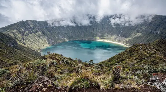
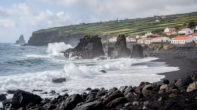
The trailhead village for Salto do Prego
Faial da Terra sits on São Miguel’s south-east coast, a short run of fishermen’s houses, a small church and a harbour wall tucked beneath the ridge that separates it from Povoação to the north. On its own, there is not much to see: a couple of cafés, a quiet waterfront, boats pulled up on the slipway. What draws people here is what starts on its edge — the path up the Ribeira do Salto valley to the Salto do Prego waterfall and the old watermill hamlet of Sanguinho, one of the more approachable waterfall walks on the eastern side of the island.
It is easy to treat Faial da Terra as a footnote to Povoação or Ribeira Quente, and geographically it is close to both — a matter of minutes by car along the coast road. But the hike itself deserves its own stop, ideally in the morning before the day’s heat or afternoon cloud settles into the valley.
Getting to Faial da Terra
From Ponta Delgada, the drive is about 55 to 70 minutes, most of it on the EN1-1A and the roads through Furnas or Povoação before dropping down to the coast. There is no shortcut on a fast road here — the last stretch is narrow, winding, and slower than the map suggests, which is normal for this side of the island. Parking is informal, on the roadside near the trailhead at the edge of the village; arriving early in high season secures an easy spot and avoids the worst of the midday sun on the return leg.
There is no train on São Miguil, and the bus network that does exist (Auto Viação Micaelense being the main operator) is built around school and work schedules rather than hiking departures, so a rental car remains the realistic way to reach the trailhead independently. Travelers without a car typically join a guided hiking day that includes transport from Ponta Delgada or Furnas.
a guided half-day hike to Salto do Prego with a picnic included takes the parking and logistics off your hands and pairs well with a first visit to this side of the island, since the guide also points out where the path narrows or gets slippery after rain.
The Salto do Prego hike, honestly described
The walk out of Faial da Terra follows the Ribeira do Salto upstream through a laurel-fringed valley, part of a numbered Azorean PR trail rather than a marked alpine route. That distinction matters: the Azores have no mountain huts, no staffed refuges, and no rescue posts along their trails. What you get instead are PR signposts at junctions, a dirt-and-stone path that narrows in places, a few stream crossings on stepping stones, and long stretches where you will meet nobody at all.
It is a genuinely rural walk through pasture and forest, not a paved nature-trail loop, and it should be treated with the same respect as any countryside hike — sturdy shoes, a look at the forecast, and an early enough start that a slower pace than planned doesn’t leave you finishing in fading light.
Most people complete the round trip, including a stop at the falls and at Sanguinho, in two and a half to three and a half hours, covering somewhere around 5 to 6 km depending on how far up the valley they go and how long they linger. The gradient is gentle by island hiking standards — nothing like the exposed ridge walks in Nordeste or the climb toward Pico da Vara — but the ground underfoot can still be uneven, muddy after rain, and edged with drops toward the stream in a few short sections.
The reward at the top is the waterfall itself: a single drop of water into a pool ringed by ferns and laurel, the kind of spot that looks staged for photographs but is entirely natural. Swimming is common in the warmer months, though the water stays cold year-round and the pool is unsupervised and untreated — read as wild swimming, with conditions that shift after heavy rain upstream, not as a managed leisure pool.
Sanguinho, the restored hamlet along the way
Partway up the valley, the path passes Sanguinho, a small cluster of stone buildings and an old watermill that has been restored as a rest stop rather than resettled as a working village. There is no café or shop here — it is shade, a bench or two, and a sense of how the valley was worked before the mills fell quiet. It makes a natural halfway point to break up the walk, especially with children, and a good spot to eat a packed lunch before continuing up to the falls or turning back.
What this hike is not
It is worth being direct about this, because the comparison trips people up. This is not an alpine trek with waymarked colour-coded blazes, emergency shelters, or a rescue infrastructure standing behind it. It follows a regional PR-numbered trail maintained on an island where several coastal and valley paths close, sometimes for extended periods, after landslides — a real risk on volcanic slopes after heavy rain.
Before setting out, especially outside the drier months, it is worth checking the regional trails site for closures rather than assuming the path described online is still open exactly as mapped. None of this makes the walk unsafe when treated sensibly; it simply means bringing the judgment you would bring to any unsupervised countryside trail, not the assumptions of a groomed alpine circuit.
The hike also sits at some distance, and outside the scope of this page, from the laurel forest reserve of the Serra da Tronqueira further north, home of the endemic priolo — that landscape and its rare bird have their own separate visit and their own page; Faial da Terra’s valley is a lower, more accessible walk and should not be confused with it.
Weather and timing on this coast
Like the rest of São Miguel’s east, conditions here can differ from what is happening in Ponta Delgada an hour away — sun on the coast at Faial da Terra while cloud sits over Furnas just inland is entirely normal. The driest, most reliable window for this walk runs from April to October, when the stream crossings are lower and the path holds up better underfoot; from November to March the valley gets wetter and greener, still walkable on a dry day but muddier and slower, with a higher chance of the trail being temporarily closed after a slide. Whatever the season, an early start beats a scheduled one — cloud and light showers tend to build through the afternoon on this side of the island.
Village facilities and eating in Faial da Terra
The village itself has a small number of simple cafés near the waterfront, useful for a coffee and a pastry before or after the walk, but nothing built around tourism the way Vila Franca do Campo or Ponta Delgada are. There is no supermarket to speak of, so it makes sense to bring water and food for the trail from Furnas or Povoação rather than count on shopping here. For a fuller meal, most visitors continue on to Povoação or backtrack to Furnas, where restaurants are used to hikers arriving mid-afternoon.
Combining Faial da Terra with the rest of the east
Because the drive between them is short, Faial da Terra pairs naturally with a day that also touches Povoação, the caldera town just up the coast, and Ribeira Quente, the beach on the far side of the ridge from Furnas. A sensible order is a morning walk to Salto do Prego while the trail is quiet and cool, lunch back in Povoação or Faial da Terra itself, then an afternoon at Ribeira Quente’s beach or a slower loop through Povoação’s own sights. None of those places should be expected to repeat what Faial da Terra offers — this hamlet’s role in a day out here is specifically the trailhead, not a second version of its neighbours’ attractions.
Travelers building a longer east-coast day sometimes fold in the waterfall park at Ribeira dos Caldeirões further north, though that adds real driving time and works better as a separate outing than as an add-on to the same morning as Salto do Prego.
a full day touring the Nordeste viewpoints and the Serra da Tronqueira is one way to see the wider east coast without doing all the driving yourself, useful if Faial da Terra is one stop among several rather than the focus of the day.
Guided and self-drive options
Independent hikers generally do fine on the Salto do Prego trail with decent shoes, water, and attention to the weather and any posted closures. For those who would rather not navigate the parking, the junctions, or the drive itself, a handful of tour options cover this corner of the island:
| Option | What it covers | Roughly suits |
|---|---|---|
| Self-drive, own pace | Trailhead parking, walk at your own speed, picnic brought from Furnas or Povoação | Confident hikers with a rental car |
| Guided hike with picnic | Transport, guide, and food included for the Salto do Prego walk | First-time visitors, no car |
| Wider east-coast day tour | Faial da Terra’s valley alongside Nordeste viewpoints and the Tronqueira ridge | Travelers with one day to cover the whole east |
| Jeep-based touring | 4x4 access to viewpoints and tracks around Nordeste, with a stop near the trailhead | Those who want to see more terrain with less walking |
a private 4x4 tour through the Nordeste countryside is a reasonable option for travelers who want the scenery of this side of the island without committing to a multi-hour hike, though it does not substitute for actually walking into the Salto do Prego valley on foot.
For a broader look at how this fits a longer stay, the Nordeste hiking itinerary and the general guide to PR trail markings and closures are useful reading before setting a date, and the island’s hiking trails overview puts Salto do Prego in context against São Miguel’s other walks.
Visiting Faial da Terra and the Salto do Prego hike: frequently asked questions
How long is the Salto do Prego hike from Faial da Terra?
The out-and-back walk runs roughly 5-6 km depending on how far along the valley you go, and takes most people 2.5 to 3.5 hours including stops at the waterfall and Sanguinho. It is not a technical route, but it is a real countryside trail, not a paved promenade.
Is the Salto do Prego trail waymarked like an alpine path?
It follows part of a numbered Azorean PR trail, marked with the region’s own PR signposts rather than alpine-style paint blazes, and there is no mountain hut, ranger post or rescue infrastructure along the way. Sections can be muddy, narrow or overgrown after rain, and the route occasionally closes after landslides, so checking the regional trails site before setting out matters more than it would on a groomed European hiking trail.
What is Sanguinho, and is it a village people live in?
Sanguinho is a small cluster of restored stone buildings and an old watermill beside the stream below Salto do Prego, kept as a rest point and picnic spot rather than an inhabited village today. It has no shop or café; it is a shaded stop on the walk, not a destination with its own facilities.
Can you swim at the Salto do Prego waterfall?
Yes, many walkers swim in the pool at the base of the falls in warmer months, though the water is cold, the pool is untreated and unsupervised, and flow and depth change with recent rain. Treat it as wild swimming, not a managed pool, and skip it after heavy weather when the stream runs high and cloudy.
Do you need a car to reach Faial da Terra?
A rental car is the practical way in, since public buses to this stretch of the south-east coast run on limited timetables not built around hiking start times. A guided hiking tour that includes transport is the easiest alternative if you are not driving.
Is Faial da Terra the same area as Povoação or Ribeira Quente?
No. Faial da Terra is its own hamlet a short drive south of Povoação, on the coast road toward Ribeira Quente, and the three are easy to combine in one day but each has a different focus: Povoação’s caldera town, Ribeira Quente’s beach, and Faial da Terra’s waterfall trailhead.
What should you bring for the walk?
Proper walking shoes with grip, a layer for changeable weather, drinking water, and a swimsuit if you plan to get in at the falls. There are no shops or fountains along the trail itself, so carry what you need from the village.