Ribeira dos Caldeirões: Nordeste's Waterfall Park Explained
What is the trail at Ribeira dos Caldeirões like?
It is a short, well-surfaced walk through a landscaped valley park in Nordeste, past restored water mills and stone tanks to two waterfalls. Paths and steps are maintained and signposted, and most visitors cover the whole loop in 30 to 60 minutes. There is no wild hiking involved and no public transport reaches it, so a rental car is the practical way in.
A valley of mills, not a mountain trail
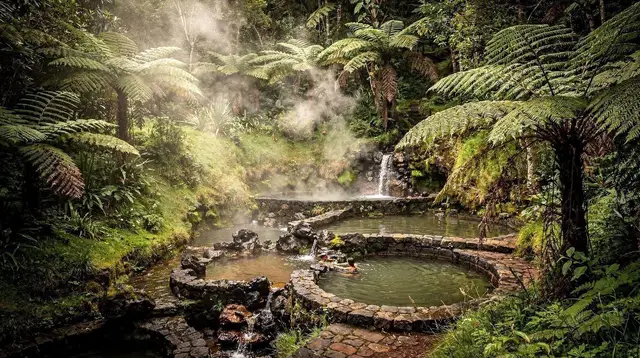
Ribeira dos Caldeirões is one of the easiest stops in the Nordeste area to get right, mostly because it asks so little of you. The park follows a short stream valley lined with restored water mills, stone irrigation channels and shallow tanks, climbing gently to two waterfalls at its head. Paths are surfaced, steps are built and signed, and the whole loop can be walked in under an hour. It is a landscaped municipal park, maintained for visitors, not a wilderness route — and that distinction matters more here than at almost any other “waterfall” stop on the island, because a few kilometres away the terrain changes completely into genuine forest hiking.
The park takes its name from the caldeirões, the rounded stone-lined pools carved by the stream over centuries, later put to work by generations of millers grinding maize into the flour that fed the villages of this corner of São Miguel. What survives today — the water wheels, the sluice gates, the low bridges — has been restored rather than reconstructed from nothing, and the atmosphere is closer to an open-air heritage site with running water than to a backcountry excursion.
Where it sits inside Nordeste
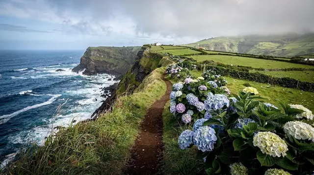
Ribeira dos Caldeirões belongs to the wider Nordeste sector, the island’s easternmost corner, known for cliff-edge viewpoints, a laurel forest interior and a coastline that gets noticeably wetter and greener than the west. The park sits inland from Nordeste town, a short drive from two of the area’s best-known lookouts: Ponta do Sossego, a compact garden viewpoint over the cliffs, and Ponta da Madrugada, further along the coast road with a wider sweep of ocean.
Nordeste town itself, the Farol do Arnel lighthouse, and the trailhead at Faial da Terra for the Salto do Prego waterfall are all within the same loop of roads, which is why most visitors treat Ribeira dos Caldeirões as one stop among several rather than a destination in its own right.
This clustering is useful to plan around. A single half-day circuit out of Nordeste town can comfortably take in the mill park, both cliff viewpoints, and a stop at the lighthouse, without long transfers between them — see the Nordeste coastal day trip guide for how those pieces fit together on the road.
No train, no shortcut: you need a car
São Miguel has no railway of any kind, and the island’s bus operators run to school and commuter timetables rather than sightseeing ones. That combination rules out public transport as a realistic way to reach Ribeira dos Caldeirões. The practical default, as for almost everywhere in the Nordeste area, is a rental car. From Ponta Delgada the drive takes roughly an hour, mostly along the EN1-1A that rings the island, narrowing and winding once past Povoação. If you are new to the island’s roads, the driving on São Miguel guide covers what to expect: narrow lanes, occasional livestock, and the fog that can settle over the higher passes.
For visitors who would rather not drive, the park is included on several organised Nordeste itineraries, which bundle it with the coastal viewpoints and sometimes a jeep route into the surrounding hills. a guided Nordeste tour built specifically around this valley and its waterfalls covers the walk with a local guide, and is the simplest way to see the park without renting a car for the day.
Walking the park
From the entrance car park, the path drops gently along the stream, passing the first of the restored mill buildings within a few minutes. Information panels along the way explain how the water was channelled from pool to pool to turn each wheel in sequence — a working system rather than a single mill, which is part of what makes the site unusual. Stone bridges cross the stream at several points, and the tanks beside the path hold clear, cold water fed straight from upstream.
The path continues upward through planted gardens — hydrangea hedges, camellias and native laurel mixed with ornamental planting — toward the head of the valley, where two waterfalls drop into pools below a viewing platform. The lower falls are the more photographed of the two, framed by a stone arch bridge that has become the park’s signature image; the upper falls sit a short flight of steps above, reached by a steeper but still built path.
Most visitors walk the full loop — mills, tanks, both waterfalls, and back to the car park — in 30 to 60 minutes. There is little reason to rush it, and picnic tables near the entrance make it easy to linger, but there is equally no need to set aside a half-day for the walk itself: the time budget for a Nordeste visit is better spent on the viewpoints and coast road around it. The Lagoa do Fogo day trip guide and hiking trails category page are useful references if you are weighing this easy walk against tougher hikes elsewhere on the island.
What to expect underfoot
The surfaces are a mix of cobbled stone, packed gravel and built steps, generally well maintained and signed in Portuguese and English. Handrails line the steeper sections near the waterfalls. After heavy rain — common in this part of the island — some stones can be slippery, and the park can feel busier with runoff and spray near the falls, but the paths themselves stay walkable in ordinary weather. Sturdy shoes are sensible; specialist hiking boots are not necessary for this particular walk, unlike the forest trails further into the interior.
There is no entrance fee and no ticket booth. A car park sits at the entrance, along with picnic tables and bins, but no café, shop or toilets on site, so it is worth arriving with water and any snacks already in hand from Nordeste town or Povoação.
What this park is not
It is worth being precise about what Ribeira dos Caldeirões is not, because the names of Nordeste’s trails get blurred together easily. This is not the forest hike into the Serra da Tronqueira, the laurel-forest interior where the rare priolo, the Azores bullfinch, survives in one of its last strongholds — that is a longer, harder walk at altitude, through genuine forest rather than a landscaped valley, and it is covered separately in the priolo trail guide.
Nor is it the same outing as a full Nordeste coastal day trip by car, which strings together the cliff viewpoints and the lighthouse along the coast road rather than concentrating on one valley park.
The confusion is understandable: all three sit within a few kilometres of each other in the same corner of the island, and all three get folded into “Nordeste” in casual conversation. But the effort required is completely different — a paved half-hour loop here, a proper forested hike there — and it is worth knowing which one you are booking or driving toward before you set off.
Nearby: the viewpoints and the lighthouse
Once the mill park is done, the obvious next stops sit within a short drive. Ponta do Sossego is a compact, planted viewpoint garden looking straight down a green cliff line to the Atlantic — one of the more photographed spots on this coast, and covered in the Ponta do Sossego and Ponta da Madrugada guide. Ponta da Madrugada, a little further along, opens onto a wider stretch of coastline and is a favoured sunrise spot for visitors staying overnight in Nordeste. The Farol do Arnel lighthouse, at the island’s easternmost point, and the trailhead village of Faial da Terra for the Salto do Prego waterfall round out a typical half-day circuit through this corner.
For visitors who would rather see the valley and the coast together with a guide handling the driving, a small-group option exists that pairs the two directly. a Nordeste and waterfalls tour that includes lunch alongside the walk through the valley runs the park together with stops along the Nordeste coast, useful if you would rather not plan the driving loop yourself.
Getting further into Nordeste’s hills
Some visitors use Ribeira dos Caldeirões as the start of a longer day exploring Nordeste’s back roads and hill country rather than the coast alone. Jeep tours cover more ground in less time than a rental car on the narrower interior lanes, and several routes are built specifically around this side of the island. a private jeep 4x4 route through Nordeste’s back roads and an East Escape route taking in Nordeste’s viewpoints and the edge of the Serra da Tronqueira both start from or pass close to the mill park, folding it into a wider look at the island’s eastern tip.
Practical notes for the visit
Nordeste is one of the wetter corners of São Miguel, and the same shower that leaves Ponta Delgada dry can settle over this valley for an hour. A light waterproof is worth keeping in the car regardless of season. Fuel stations thin out east of Ribeira Grande, so it is sensible to fill up before setting out on the Nordeste loop, as covered in the island’s driving guide.
Trail and park conditions occasionally change after storms — the regional PR trail network sees periodic closures elsewhere on the island, and it is worth a quick check before setting out if you plan to extend the day onto marked walking trails; see the note on PR trail markings and closures for how that system works.
If Ribeira dos Caldeirões is your only stop of the day and you are travelling without a car, the guided options above are the realistic route in. If you are driving yourself, treat the park as a 45-minute pause within a longer Nordeste loop rather than a destination that needs its own half-day — the Nordeste coastal day trip guide lays out how to sequence it with the viewpoints and the lighthouse for a full circuit from Ponta Delgada and back.
Ribeira dos Caldeirões, questions answered
What is Ribeira dos Caldeirões?
It is a landscaped valley park on the Ribeira dos Caldeirões stream in the Nordeste area, built around a cluster of restored 19th-century water mills, stone channels and tanks, with two waterfalls at its head. It is a maintained municipal park, not a backcountry trail.
Where is Ribeira dos Caldeirões in relation to Nordeste?
It sits inland from Nordeste town, in the same eastern corner of São Miguel as the coastal viewpoints of Ponta do Sossego and Ponta da Madrugada. All three are reachable from Nordeste within a short drive of each other.
How do you get to Ribeira dos Caldeirões without a tour?
By rental car. São Miguel has no train, and the scheduled bus network is built around school and work timetables rather than sightseeing, so it does not serve the park on a useful schedule. The drive from Ponta Delgada takes roughly an hour.
How long does the walk through the park take?
Most visitors walk the full loop, mill buildings and waterfall viewpoints included, in 30 to 60 minutes at an easy pace. There is no need to budget half a day unless combining it with other Nordeste stops.
Is Ribeira dos Caldeirões suitable for children or older visitors?
Yes, for most of the park. Paths are surfaced and signposted with picnic areas and low walls near the water, though the steps down toward the lower waterfall are steeper and need supervision with small children.
Is there an entrance fee?
No, the park is free and open-air with no ticket booth. There is a car park at the entrance and basic picnic tables, but no café or shop on site, so bring water and snacks from Nordeste.
What is the difference between Ribeira dos Caldeirões and the Serra da Tronqueira priolo trail?
Ribeira dos Caldeirões is a short, accessible valley walk among restored mills. The Serra da Tronqueira trail is a genuine forest hike, higher and longer, into the laurel forest where the rare priolo bird lives — a different level of effort and a different kind of place.
Can you combine Ribeira dos Caldeirões with Ponta do Sossego and Ponta da Madrugada in one day?
Yes, comfortably. All three sit within Nordeste’s compact eastern corner, and visitors typically link the park with both viewpoints, and often Farol do Arnel, in a single half-day loop by car.
Hiking Trails on GetYourGuide
Verified deep-linked GetYourGuide tours. Book through these links and we earn a small commission at no cost to you.
GetYourGuide does not provide a product photo for this activity — the image shows the meeting point, photographed by us.