Nordeste Coastal Day Trip: Viewpoints, Lighthouse and Waterfalls
How do you spend a day on the Nordeste coast of São Miguel?
Drive the eastern loop from Ponta Delgada or Furnas, stringing together the Ponta do Sossego and Ponta da Madrugada viewpoints, the Farol do Arnel lighthouse, and the Ribeira dos Caldeirões waterfall park. Allow a full day, fill the tank before you set out, and treat any glimpse of Pico da Vara as a backdrop rather than a wildlife excursion.
Why the eastern loop deserves its own day
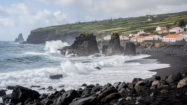
Nordeste is the far corner of São Miguel, the part of the island where the roads narrow, the hedgerows close in, and the coastline turns to cliff after cliff of pasture dropping into the Atlantic. It is not a stop you fold into a Furnas afternoon or bolt onto the north coast on the way back to Ponta Delgada. The driving alone — looping out along the coast road and back through the interior, or the other way round — takes a genuine chunk of a day, and the two headline viewpoints, the lighthouse, and the waterfall park each want more than a photo stop to be worth the drive.
This guide covers the coastal version of that day: Ponta do Sossego and Ponta da Madrugada, the Farol do Arnel lighthouse, and the Ribeira dos Caldeirões waterfall park. It does not cover the laurel-forest walk toward the priolo’s habitat, and it does not cover the jeep version of this same ground — both are real, both are good, and both are different trips. More on why below.
Fuel up before you leave — this is not optional
Petrol stations thin out fast once you’re past Ribeira Grande or Povoação. The Nordeste loop runs through small parishes with a handful of shops and no guarantee of an open pump, and the roads themselves are slow: narrow, bent around field walls, occasionally down to single track where you wait for an oncoming car or a loose cow. Running the tank down on the coast road east of Nordeste town is the kind of mistake that turns a scenic day into a stressful one, so top up in Ponta Delgada, Ribeira Grande, or Povoação before you commit to the circuit. There is no shortcut around this: treat the fuel stop as the first item on the itinerary, not an afterthought.
A rental car is the practical way to do this drive. Public buses reach Nordeste town on a timetable built for residents and school runs, not for stringing together three or four stops along a coast road with no fixed schedule between them. If you’d rather not drive it yourself, several operators run the same ground as a guided outing — see the tour options at the end of this page.
Pico da Vara, watching from above
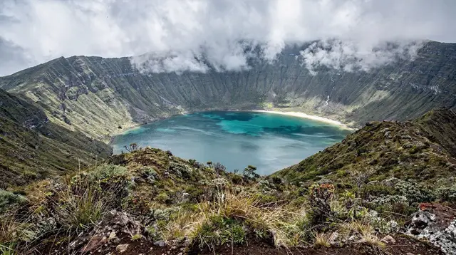
You don’t climb it on this drive, but you can’t miss it either. Pico da Vara, São Miguel’s highest point at 1,103 metres, sits inland from the Nordeste coast road and shows up again and again as you drive — sometimes clear against the sky, more often wearing a collar of cloud, since this end of the island catches weather that Ponta Delgada, thirty-odd kilometres west, never sees at all. Its slopes carry the Serra da Tronqueira, the last significant stretch of native laurel forest on the island and the only place on Earth the priolo survives. You’ll be looking at that forest from the road at several points on this route.
Treat Pico da Vara as scenery on this trip rather than a destination. Reaching the summit is a hiking day in its own right, with a trailhead, a proper ascent, and weather considerations that have nothing to do with a coastal drive in a rental car. If the peak pulls at you, plan it separately.
Ponta do Sossego: the first viewpoint
Ponta do Sossego is a small, formal garden-viewpoint above the cliffs, with terraced flowerbeds, a gazebo, and a view that runs along the coast in both directions on a clear day. It’s an easy stop — a short walk from the parking area, benches if you want to linger, and one of the more photographed spots on this side of the island, particularly when the hydrangeas are out from June onward. Give it fifteen to twenty minutes, longer if the light is good.
Ponta da Madrugada: the second, and the better light
A little further along the coast, Ponta da Madrugada is the less manicured of the two viewpoints — a cliff-edge lookout with sweeping views south and east, and a reputation as one of the better sunrise and late-afternoon spots on the island (the name means “dawn point”). If your day trip runs into the afternoon, this is the stop to save for softer light. Like Ponta do Sossego, it’s a short walk from parking, no facilities beyond a bench or two, and worth pausing at rather than rushing through.
Between the two viewpoints, the coast road itself does a lot of the work: expect frequent pull-offs, grazing cattle close to the tarmac, and views that open and close as the road threads through hedgerows and pasture.
Farol do Arnel: the lighthouse at the island’s edge
The Farol do Arnel sits on a headland near the eastern tip of the island, reached by a short walk down from a small parking area above Nordeste town. It’s a working lighthouse, not a museum — there’s no visitor centre, no ticket booth, nothing indoors to see — and the point of the stop is standing on the cliff beside it, looking back along the coast you’ve just driven and out at open Atlantic with nothing between you and the horizon. Fog rolls through this stretch of coast often enough that it’s worth checking conditions before you make the detour; on a clear day it’s one of the most exposed, dramatic viewpoints on São Miguel, and on a foggy one there is genuinely nothing to see.
Give the lighthouse thirty minutes including the walk down and back. It sits slightly off the main loop, so factor the detour into your timing rather than assuming it’s directly on the route.
Ribeira dos Caldeirões: waterfalls and a working watermill
Ribeira dos Caldeirões is a small landscaped park built around a waterfall and a stream gorge, with stone paths, a restored watermill, and enough greenery that it feels like a different climate to the open, wind-scoured viewpoints earlier in the day. The paths are short and well maintained — you can see the main waterfall and the mill in well under an hour, or linger longer if you brought a picnic, since there are tables on site.
It’s the natural last stop on a Nordeste coastal day: sheltered, shaded, and a change of pace after several hours of cliff-edge views and cattle-slowed driving. If you’re doing this loop as a guided full-day Nordeste excursion, Ribeira dos Caldeirões is usually where operators build in the longest pause of the day.
What this day trip does not cover — and why
Two things are deliberately left out of this itinerary, and it’s worth being clear about both so you don’t plan around a promise the day can’t keep.
The first is the priolo. The Azores bullfinch survives only in the laurel forest of the Serra da Tronqueira, above and inland from everything described here, and it is not a roadside bird. You will not see one from the coast road, from a viewpoint, or from a car window at any point on this drive — not because of bad luck, but because its habitat is forest interior, not open coastline. Seeing a priolo means joining a dedicated walk into the forest with someone who knows the terrain; that trip belongs to a different guide.
The second is the jeep circuit. Several operators run this same corner of the island as an open-top 4x4 tour, which is a genuinely different way to see it — rougher tracks, different stops, a different pace — but it isn’t what this page describes, and the self-drive route above doesn’t require a jeep at any point.
The third is Faial da Terra and the Salto do Prego waterfall. That trailhead sits further south along the coast, past Povoação, and reaching the waterfall means a hike down through a valley rather than a stop you pull up next to — it’s a different kind of morning entirely from a viewpoint or a lighthouse. It shares the general eastern end of the island with everything described here, and a fit traveller could in theory chase both in one very long day, but treating it as an add-on undersells it. See the dedicated guide to the Salto do Prego waterfall hike from Faial da Terra if it appeals — it deserves its own day, not the last hour of this one.
A sample order for the day
There’s no single correct sequence, but the loop below keeps driving sensible and saves the best light for the afternoon.
| Stop | Suggested time | Notes |
|---|---|---|
| Fuel up (Ponta Delgada or Ribeira Grande) | Before departure | Last reliable pumps before the loop |
| Ponta do Sossego | Mid-morning | Formal viewpoint garden, 15-20 minutes |
| Farol do Arnel | Late morning | Short walk down from parking; skip if fogged in |
| Ribeira dos Caldeirões | Midday | Waterfalls, watermill, picnic tables |
| Ponta da Madrugada | Afternoon | Best light later in the day |
Reverse the order if you’re basing yourself in Furnas rather than Ponta Delgada — Povoação and the eastern approach put Ribeira dos Caldeirões closer to the start of your day.
Povoação itself works as a base for this loop, and for some travellers it works better than Furnas: it sits closer to the start of the coast road, which cuts a meaningful stretch off the drive to Ribeira dos Caldeirões and leaves more of the day for the viewpoints and the lighthouse. It’s a smaller town with fewer places to eat than Furnas, so plan meals around that rather than assuming you’ll find options on the way, but the shorter drive can buy you an extra twenty or thirty minutes at whichever stop has the best light on the day. See the guide to Povoação and Ribeira Quente if you’re weighing it as a base for more than just this excursion.
Practical notes for the drive
The Nordeste coast road is narrow throughout, with tight bends, occasional single-track sections, and livestock that treat the tarmac as part of the field. Expect the drive itself to take longer than the map distance suggests. Weather on this side of the island can differ sharply from Ponta Delgada or the north coast — check conditions before committing to the Farol do Arnel detour in particular, since a fogged-in headland has nothing to offer. For trail conditions on any of the short walks along this route, check the regional trails site before setting out; coastal paths here occasionally close after landslides.
Pack for the coast, not for whatever the day looks like when you set out. Nordeste sits on the wetter, more exposed side of the island, and a bright morning in Ponta Delgada or Furnas says nothing about what you’ll find at Ponta da Madrugada or the lighthouse a couple of hours later — cloud can roll in and clear again within the same afternoon.
A waterproof layer, decent shoes for the short walks at each stop, and a jumper even in summer cover most of what this drive throws at you. The general weather guide and packing list cover the fuller picture, and the note on how weather changes hour to hour on this island is worth the short read if you want the version specific to days like this one.
Hydrangea season, roughly June through September, also lines long stretches of this coast road with hedges of blue and white blossom, softening the drive between stops and filling out the photos at both viewpoints. Outside that window the same road is starker and often quieter, with fewer cars sharing the pull-offs at Ponta do Sossego and Ponta da Madrugada — a trade some travellers prefer.
If you’d rather hand the driving to someone else, the operators below run this ground as guided outings, several with lunch included, which also solves the fuel-stop question entirely.
a full-day guided excursion covering the Nordeste coast is the closest match to the self-drive route above, run at a similar pace with the driving handled for you.
For a version built around the waterfall park itself, a tour focused on Nordeste’s unspoiled landscapes and Ribeira dos Caldeirões spends more time in the gorge and less on the open coast road.
If lunch is part of the plan, a guided Nordeste and waterfalls tour with lunch included folds a sit-down meal into the day, useful given how thin on the ground restaurants are once you’re past Povoação.
And for a route that leans harder on the high country above the coast, an East Escape tour taking in Nordeste’s viewpoints and the Serra da Tronqueira pairs the coastal stops with views up toward the laurel forest, without attempting the priolo trail itself.
Related reading
For the two viewpoints in more depth, see the dedicated guide to Ponta do Sossego and Ponta da Madrugada. For the waterfall park on its own, there’s a full Ribeira dos Caldeirões trail guide. If Pico da Vara has caught your attention, the summit guide covers what actually reaching it involves.
And if you want the priolo itself rather than its forest from the road, start with the Azores bullfinch guide to the Serra da Tronqueira — the dedicated laurel-forest trail is the only realistic way to see one.
Drivers who’d rather go rougher and higher can compare this route against the Nordeste jeep 4x4 tour, and for trail conditions generally, our note on PR trail markings and closures is worth a read before any of the short walks along this coast. Multi-day planners can slot this into a broader hiking-and-viewpoints itinerary or check general driving and car-rental advice and the wider things to do around Nordeste before setting out; the travel tips hub covers fuel, roads, and timing for the rest of the island too.
Day Trips on GetYourGuide
Verified deep-linked GetYourGuide tours. Book through these links and we earn a small commission at no cost to you.
GetYourGuide does not provide a product photo for this activity — the image shows the meeting point, photographed by us.