Pico da Vara: São Miguel's Summit, Reconsidered
What does 'summit' mean on São Miguel — is Pico da Vara climbable?
Pico da Vara, at 1,103 m, is the highest point on São Miguel, rising inside the protected laurel forest of the Serra da Tronqueira in the east. It is reached on foot along marked trails, not climbed with mountaineering gear — the island has no glacier, no ski area, and no cable car anywhere.
What “the summit” actually means here
If you have hiked in the Alps, the Pyrenees, or the Rockies, the word summit probably calls up a specific picture: a rocky final push above the treeline, a marked refuge somewhere below, maybe crampons or a headlamp for an early start, and a view that opens out over glaciers or a chain of peaks stretching to the horizon. None of that exists on São Miguel, and the island’s highest point, Pico da Vara, will disappoint anyone who arrives expecting a version of it.
Pico da Vara sits at 1,103 m, the tallest point on the island, in the far east near Nordeste. It rises out of the Serra da Tronqueira, a block of ancient, heavily eroded volcanic terrain that is nothing like the sharp, young calderas found elsewhere on São Miguel. There is no crater at the top, no exposed rock scramble, and on most days no long-distance view at all, because the summit sits inside cloud far more often than it sits above it. What you find instead is forest: dense, low, wind-shaped native laurel forest running almost to the top, thinning only slightly near the ridge.
This is worth saying plainly before anything else on this page: reaching Pico da Vara is a walk through a nature reserve, not a mountaineering objective. There is no technical climbing anywhere on São Miguel, no via ferrata, no roped pitches, and nothing resembling an alpine ascent. If that is what you came looking for, this island will not provide it, and no operator on São Miguel sells it, because it does not exist here.
No glaciers, no ski area, no cable car — full stop
It is worth being explicit about what São Miguel does not have, because visitors from mountain countries sometimes assume infrastructure that simply was never built.
There is no glacier on São Miguel, or anywhere in the Azores. The islands are volcanic and sit in the middle of the North Atlantic at a latitude too mild and an elevation too modest for permanent ice. There is no ski area and no snow sports infrastructure of any kind — winter here means rain, wind, and mild temperatures, not powder. And there is no cable car, chairlift, or gondola anywhere on the island. Every viewpoint, every crater rim, and the Pico da Vara ridge itself are reached the same way: on foot, or in the case of some lower viewpoints, by road right up to a car park.
This matters for how you plan. A “summit” trip on São Miguel is a walking day, weather-dependent and reserve-dependent, not a lift-assisted outing with a hut at the top. Pack for rain and wind rather than altitude, and expect that the reward may be forest and mist rather than a panoramic photograph.
Where Pico da Vara sits, and why it looks nothing like Sete Cidades
Most of what visitors photograph on São Miguel comes from the island’s younger, more dramatic volcanic features: the twin-lake caldera at Sete Cidades, the steaming ground at Furnas, the exposed crater bowl of Lagoa do Fogo. Those are all wide-open, recently active volcanic landscapes with clear sightlines down into a crater or a lake.
The Serra da Tronqueira and Pico da Vara belong to a different, older part of the island’s geology — for context on how the island’s volcanic systems relate to one another, see this overview of São Miguel’s volcanic history, and this explainer on the difference between caldeiras and lava tubes.
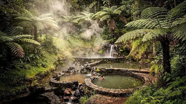
Rather than a crater rim with a lake inside it, the eastern massif is a long, folded ridge of eroded volcanic rock, softened by rain and time and now almost entirely covered in native forest. There is no lake at the top of Pico da Vara and no obvious volcanic feature to point a camera at. The landscape reward here is different in kind: it is one of the last intact fragments of the kind of forest that covered these islands before people, cattle, and imported species arrived.
That forest, called Azorean laurisilva, is the actual reason Pico da Vara matters beyond its number on a map.
The forest is the point, not the altitude
At 1,103 m, Pico da Vara is not a dramatic elevation gain by most hiking standards — it is roughly comparable to a mid-sized hill in many mountain countries. What makes it significant is what grows and lives on the way up: a stand of native Azorean laurel forest old and intact enough to still support species that have vanished from almost everywhere else on the island.
Chief among them is the priolo, the Azores bullfinch, a small, russet-brown finch found nowhere else on Earth outside this one corner of São Miguel. It is one of the rarest birds in Europe, and its entire breeding range is confined to the laurel forest of the Serra da Tronqueira. This is a genuinely important detail for planning expectations: the priolo does not turn up at roadside viewpoints, does not sit conveniently near a car park, and is not something you glimpse from the window of a rental car on the way to Nordeste’s coastal lookouts.
Seeing one, or even hearing one, generally means walking quietly into the forest itself, often with someone who knows its calls and habits, and even then a sighting is a matter of patience rather than certainty. For more on the bird itself and where it survives, see this guide to the priolo and the Serra da Tronqueira, and this walking-focused look at the Serra da Tronqueira priolo trail.
Because the habitat is this fragile and this narrow, the reserve is managed accordingly. Paths are marked and maintained specifically to keep foot traffic away from the understorey the birds and other endemic species depend on. Leaving a marked trail here is not a minor shortcut the way it might feel on an open hillside elsewhere — it is a direct intrusion into one of the last refuges of a species that exists nowhere else on the planet. Whatever route or operator you go with, staying on the marked path near Pico da Vara is not a suggestion, it is the entire point of the protection in place.
What a visit actually looks like
Because this page deliberately does not lay out a specific trail with a timed itinerary or a difficulty rating — conditions, closures, and access points change, and the honest answer depends on the day — think of a visit to this area in more general terms.
Most visitors experience the Serra da Tronqueira and its high ground as part of a wider day around Nordeste rather than as a single dedicated summit push. The eastern tip of the island is already a full day out from Ponta Delgada: the coastal viewpoints, the waterfall park, the laurel forest, and the high ground all sit within a compact area, and a guided vehicle-based day is the most common way to see several of them without needing to plan a technical route yourself.
For a broader sense of what a day out here covers, see this Nordeste coastal day trip guide and this look at the area’s best-known lookouts, Ponta do Sossego and Ponta da Madrugada.
a private 4x4 day through Nordeste’s back roads and viewpoints is one practical way to cover the eastern end of the island, including approaches toward the high ground, without self-navigating unfamiliar tracks. For those who want the laurel forest and its scenery explained rather than just driven past, a guided outing focused on the Nordeste viewpoints and the Serra da Tronqueira itself puts a local guide’s knowledge of the terrain and its wildlife between you and the reserve, which matters in an area where the value of a visit is largely about knowing where and how to look.
A more waterfall-and-nature-focused alternative, a guided Nordeste tour that also stops at Ribeira dos Caldeirões with lunch included, covers the area’s other headline feature alongside time in the wider landscape.
Whichever way you approach it, cloud is the variable that decides more than anything else. The ridge line around Pico da Vara catches Atlantic weather systems earlier and holds them longer than the lower coastal viewpoints nearby, so a clear morning at Ponta da Madrugada does not guarantee a clear summit an hour later. Locals and guides read this hour by hour rather than trusting a forecast made the night before, and it is worth building the same flexibility into your own plans — treat a clear view from the top as a bonus, not an expectation.
Setting expectations before you go
For visitors coming from genuinely mountainous countries, the adjustment is mostly about scale and infrastructure rather than difficulty. There is no altitude to acclimatize to, no technical grading system, no mountain hut network, and no rescue infrastructure built around alpine-style ascents, because nothing here calls for any of that. What replaces it is a small, damp, wind-battered patch of ancient forest holding a bird found nowhere else on the planet, reached by walking rather than climbing, and best understood as a piece of living conservation rather than a peak to tick off.
That reframing is really the honest answer to what “reaching the summit” means on São Miguel: less a physical challenge, more a quiet walk into one of the last corners of the island that looks the way all of it once did, before farming, cattle, and imported trees reshaped almost everywhere else. It rewards patience and quiet more than fitness, and cloud more often than not.
For a sense of how the wildlife protections here compare with the rest of the island’s genuinely mild hazards — sea, cliff edges, and weather rather than anything dangerous underfoot — see this overview of what’s actually risky (and what isn’t) on São Miguel, and for context on trail signage and closures across the island more broadly, this note on PR trail markings and closures is a useful companion before setting out anywhere in the reserve system.
What this island is, and isn’t
It is worth stepping back to the wider point, because visitors researching “summits” and “peaks” often arrive with the whole Azores archipelago blurred into one place in their head. São Miguel’s high ground is forest, not glacier or rock; the archipelago’s genuinely dramatic volcanic peak, complete with its own microclimates and a very different kind of ascent, belongs to Pico island, not here — see this comparison of São Miguel against Terceira for a sense of how differently the islands are built.
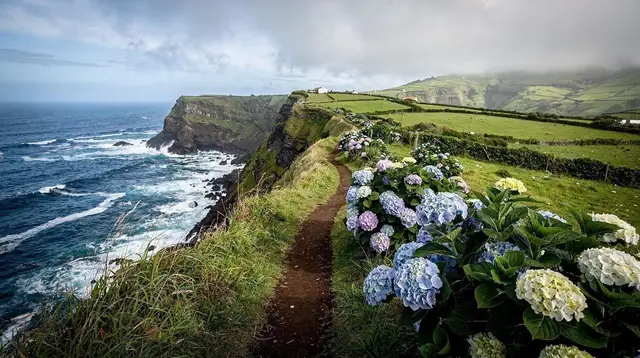
And more broadly, this is not a wilderness in the untouched sense at all: it is a farmed, inhabited island of pasture and hedgerow right up to the edge of its protected forest fragments, a point covered in more depth in São Miguel is not the whole Azores and São Miguel is farmed, not wilderness.
Pico da Vara, seen this way, is less a summit to conquer and more a reminder of what almost the entire island looked like before it was settled — and one of the very few places left where that older landscape, and the bird that depends on it, still survives.
Planning a day around the eastern high ground
a small-group tour through Nordeste’s unspoiled nature and the Ribeira dos Caldeirões waterfalls works well as a way to see the eastern landscape at a slower pace, with time built in for the forest itself rather than a checklist of stops. For visitors basing themselves near Ponta Delgada rather than staying overnight in the east, a guided hike from Ponta Delgada to Moinho do Félix offers a different, lower-elevation walking outing on the island’s forested slopes if the Nordeste weather forecast looks unpromising on the day.
However you choose to spend a day around the island’s highest ground, arrive with the expectations reset: pack for rain rather than altitude, treat cloud cover as the default rather than the exception, and remember that the marked trail is not a formality here — it is what keeps one of Europe’s rarest birds, and the forest it depends on, intact for the next visitor as well.
Frequently asked questions about Pico da Vara and São Miguel’s high ground
Is Pico da Vara a mountain you climb, like in the Alps?
No. There is no roped climbing, no via ferrata, and no technical ascent involved anywhere on São Miguel. Pico da Vara is a forested summit reached by walking, and it sits inside a strictly protected nature reserve where the only sanctioned movement is along marked paths.
How high is Pico da Vara?
1,103 m above sea level, which makes it the highest point on São Miguel and one of the higher summits in the Azores archipelago, though still far short of the volcanic peak on Pico island.
Can you see the priolo from Pico da Vara or from a car?
Almost never from a road, and not reliably even close to the summit. The priolo keeps to the interior of the laurel forest canopy in the Serra da Tronqueira and is found by patient, quiet walking, usually with local guidance, not by driving past.
Is there a cable car, chairlift, or ski area on São Miguel?
No. There is no cable car, no chairlift, and no ski infrastructure anywhere on the island. Every viewpoint and every summit is reached on foot or, at lower elevations, by road.
Why can’t visitors leave the marked trails near the summit?
The Serra da Tronqueira is a protected reserve holding one of the last stands of native Azorean laurel forest and the entire breeding range of the priolo, an endangered endemic bird. Off-trail movement damages the understorey the bird depends on, which is why access is restricted to signed paths.
What’s the difference between a summit here and a caldeira rim?
A caldeira rim, like the one above Sete Cidades or Lagoa do Fogo, is the collapsed edge of a volcanic crater and often gives a wide, open view down into a lake. Pico da Vara is a forested summit on the older, eroded eastern massif, with no crater beneath it and a view mostly framed by canopy and cloud rather than open sky.
Is the Pico da Vara area open to visitors year round?
The forest itself is accessible year round, but cloud sits on the summit ridge for long stretches, especially in autumn and winter, and paths can be muddy or temporarily closed after storms. Visibility, not a locked gate, is usually what limits a visit.
Climbing & Summits on GetYourGuide
Verified deep-linked GetYourGuide tours. Book through these links and we earn a small commission at no cost to you.
GetYourGuide does not provide a product photo for this activity — the image shows the meeting point, photographed by us.