A Village Built Inside a Volcano
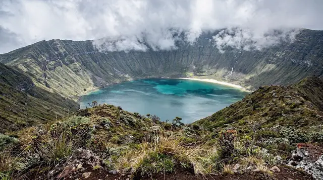
Sete Cidades is not a lookout point with a car park attached to it, though most visitors meet it that way first. It is a working village of a few hundred people, sitting on the flat floor of a caldera roughly five kilometres across, with pasture running down to the water on every side and cattle grazing between the houses. The road drops nearly 300 metres from the rim to reach it, switching back through cryptomeria forest before it opens onto a wide green bowl with a lake filling most of the middle. That first view from the rim, before the road even starts to descend, is the single most photographed scene on São Miguel.
The name means “seven cities,” and depending on which telling you hear it goes back either to a legend of seven bishops who sailed off after the fall of the Iberian Peninsula, or simply to seven parishes that once ringed the crater. Geologically the story is more useful: this is one enormous volcano, still classified as active though quiet for centuries, and the caldera is its collapsed summit. Everything a visitor comes to see — the lake, the rim viewpoints, the hot ground further along the coast at Ponta da Ferraria — belongs to the same volcanic system.
For the fuller geological story of how this particular crater formed, and how it fits alongside the island’s other volcanic centres, the dedicated Sete Cidades volcano explained guide goes into the eruption sequence in more depth than fits here, and the general São Miguel overview places this caldera in the context of the island as a whole.
One Lake, Two Colours — Not Two Lakes
The detail that trips up almost every guidebook photo caption: Lagoa Azul and Lagoa Verde are not two separate lakes. They are two connected arms of a single body of water, joined by a narrow channel under a small road bridge near the village. Stand on that bridge and you can watch the same water flow from one side to the other.
The colour difference is real but it is a trick of light and depth, not a difference in what is dissolved in the water. The Lagoa Azul arm sits in deeper water and reflects more open sky, which reads as blue from a distance; the Lagoa Verde arm is shallower, closer to tree cover, and picks up more green from the vegetation and lake bed.
Move the light, move the season, move your own position on the rim, and the two arms can look almost identical, or the “blue” side can look grey while the “green” side looks turquoise. There is no chemical boundary between them and no sudden change in the water if you swim or paddle from one arm to the other. Treat any claim of two different lakes with two different waters as a myth worth correcting on the spot — it is the single most common misunderstanding visitors carry away from this crater.
This particular piece of folklore comes up often enough that it has its own short explainer: see why the lake shows two colours for the condensed version of the same point.
Vista do Rei: The View Everyone Comes For
Vista do Rei — “the king’s view” — is the viewpoint on the southern rim where the road first breaks out of the forest and the whole caldera opens up below. It earned its name from a planned 1949 royal visit that never actually happened, but the view needed no royal endorsement to become the island’s signature image: both arms of the lake laid out side by side, the village a scatter of white roofs on the crater floor, and on a clear day the far rim visible five kilometres across.
Immediately behind the viewpoint stands the shell of the Monte Palace Hotel, a modernist building opened in 1989 and abandoned within a couple of years — it appears in almost every photograph from this angle whether visitors mean to include it or not, roofless and covered in graffiti, and it has become a landmark in its own right rather than an eyesore to crop out. The viewpoint has a car park, a small souvenir stall most days, and no entry fee. It is also the one spot on this itinerary that gets genuinely crowded around midday in July and August, when tour buses and rental cars stack up along the roadside; arriving before 9am or after 5pm buys a much emptier rim and, more often than not, calmer light for photographs.
Cloud is the real gatekeeper here, not crowds. Sete Cidades sits high enough, and close enough to the Atlantic, that the rim can be sitting inside cloud while Ponta Delgada twenty-five minutes away is in full sun. There is no reliable way to predict a clear Vista do Rei from a general island forecast — locals simply check again in an hour, or come back the next morning. No visit to this crater should be planned around a guaranteed view.
Boca do Inferno and Lagoa do Canário
A short drive and a short walk from Vista do Rei, along the rim road toward the western side of the caldera, Boca do Inferno — “mouth of hell,” a name that turns up on volcanic terrain across the island and refers to the drop rather than any heat — looks down over a third, smaller lake, Lagoa do Canário, cupped in its own minor crater within the larger one.
The path to the viewpoint is short and largely flat, a few minutes from a small parking area, which makes it an easy add-on rather than a detour that needs its own half day. From here the angle on the twin lakes changes again, with Lagoa do Canário in the foreground and the main lake framed beyond it — a useful second composition for anyone who has already shot the standard Vista do Rei angle.
Grota do Inferno
Grota do Inferno sits lower on the caldera’s flank, closer to the village than the rim viewpoints, where a stream drops through a narrow, forested ravine. It is a quieter, shadier stop than the open rim, more about the sound of running water and tree ferns than a panoramic photograph, and it rarely holds more than a handful of visitors at a time. Together with Boca do Inferno it rounds out a loop that most drivers can complete in an hour or two beyond the time spent at Vista do Rei itself.
The Village on the Crater Floor
Down at lake level, Sete Cidades village is small and unhurried: a church with a blue-and-white facade facing a modest square, a scatter of cafés and one or two restaurants that keep local hours rather than tourist ones, and pasture running almost to the water’s edge. Hydrangea hedges line the lanes and the lakeshore road, planted originally as living fences between fields; they flower from June with a peak in July, and for a few weeks the blue and pink hedgerows frame the lake almost as insistently as the rim view does from above. Outside that window the village is green but the hedges are just hedges — plan a hydrangea-focused visit for summer, not any other season.
A paved lakeside road follows the shore for a stretch and makes an easy, flat walk or cycle away from the traffic on the rim road, with views back up toward Vista do Rei from below rather than above. It is a good option for anyone who wants time by the water without committing to a full rim hike.
For a longer look at the flowering season across the caldera rim and along this lakeshore, the hydrangeas and Sete Cidades viewpoints photo guide covers timing and the best angles in more detail, and the short note on when hydrangeas actually bloom is worth a read before building a summer visit around them.
Getting There — and Why the Road Sometimes Closes
Sete Cidades sits about 25 to 30 minutes’ drive west of Ponta Delgada on a well-surfaced but narrow and winding road, the same general character as the routes to Lagoa do Fogo elsewhere on the island. A rental car is the simplest way in and the only way that lets you link Vista do Rei, Boca do Inferno, Grota do Inferno and the village into one morning without waiting on anyone else’s schedule.
The rim road is exposed high ground on the edge of the Atlantic, and it shares Lagoa do Fogo’s vulnerability to weather: fog can close the top section down to a few metres of visibility, and strong wind occasionally leads to a precautionary closure of the viewpoint car parks. Neither happens on a fixed schedule, and neither is something a visitor can check from a standard weather app — if the morning looks socked in from Ponta Delgada, it is worth calling ahead or simply trying again later in the day rather than driving up blind.
For visitors without a car, organised transport is the practical answer, and it removes the guesswork about parking at Vista do Rei on a busy August morning. A guided half-day trip from Ponta Delgada that takes in Vista do Rei, Boca do Inferno and time down by the lake covers the core sights in a morning or afternoon without needing to drive the rim road yourself, and a small-group minibus tour linking Sete Cidades with the island’s other crater lakes is a reasonable option for visitors who want the wider volcanic picture in one outing rather than two separate trips.
| Getting to Sete Cidades | Approx. time from Ponta Delgada | Notes |
|---|---|---|
| Self-drive rental car | 25-30 min | Most flexible; road can close in fog or high wind |
| Half-day guided tour | Included in tour length | No parking or navigation to manage |
| Public bus | Longer, limited departures | Runs on local timetables, not sightseeing ones |
| Taxi | 25-30 min | Simple one-way option, agree a return time or fare |
Visitors weighing a rental car against organised transport for the whole island, not just this one trip, may find the self-drive versus guided tours comparison useful groundwork, and the general notes on renting a car on São Miguel cover the practicalities of picking one up at the airport. Anyone relying on the public network should check timings first against the island’s bus guide, since the service reaching Sete Cidades runs on local schedules rather than sightseeing ones.
Walking and Hiking Around the Caldera
Beyond the roadside viewpoints, the full caldera rim is walkable. A marked trail traces the crater edge for around 12 kilometres, climbing gently between farmland and pockets of forest with the lake constantly reappearing below at different angles — arguably a better way to understand how the two-armed lake actually sits inside the volcano than any single viewpoint offers. Full-length walkers should allow four to five hours, decent footwear, and rain protection regardless of forecast; this is the same exposed, fog-prone high ground as the rim road, and shelter is limited once you are away from the car parks.
For visitors who want the reward without the full loop, a shorter out-and-back section from Vista do Rei covers the most scenic stretch of rim in an hour or two. A guided walking route along the Serra Devassa ridge toward Mosteiros extends the rim walk further west for hikers who want a longer day and don’t mind arranging transport back.
Anyone planning the full loop rather than the short out-and-back should read the dedicated caldera rim walk guide first, which breaks the roughly 12-kilometre route into stages and flags where shelter runs out on the exposed sections.
On the Water and Off-Road Around the Caldera
The lake itself is calm, sheltered water inside the crater rather than open Atlantic, which makes it a genuinely different experience from the coastal watersports found elsewhere on the island — kayaking here means gliding across still water between the blue and green arms rather than reading a swell. Small operators in the village rent kayaks and paddleboards by the hour, and a paddle across the channel under the bridge is the closest thing to physical proof that this is one lake, not two. The Sete Cidades lakes kayaking guide covers rental logistics and the calmest times of day for anyone planning to get on the water rather than just look at it from the rim.
For visitors who want to cover more ground than a walk allows without renting a car, jeep and quad tours run set routes through the caldera’s back lanes and up onto sections of rim that ordinary traffic doesn’t reach, adding vantage points beyond Vista do Rei itself. A jeep tour through the crater’s back roads and rim tracks is a straightforward way to see more of the caldera in a fixed few hours, with a driver who knows exactly which viewpoints are worth the stop that day.
Comparing the Viewpoints
| Viewpoint | What you see | Effort |
|---|---|---|
| Vista do Rei | Full caldera, both lake arms, abandoned Monte Palace Hotel | None — roadside car park |
| Boca do Inferno | Third lake, Lagoa do Canário, in its own minor crater | Short, mostly flat walk |
| Grota do Inferno | Forested ravine and stream, lower on the caldera flank | Short walk, shaded |
| Caldera rim trail | Continuously changing angles on the full lake | 1-2 hours (short section) to 4-5 hours (full loop) |
What This Page Doesn’t Cover
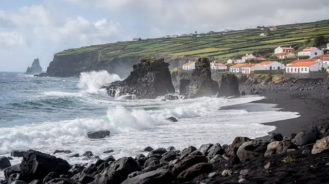
Sete Cidades sits in the same western corner of São Miguel as two other well-known stops that each deserve their own visit rather than a rushed add-on: Mosteiros, with its black-sand beach and sea stacks on the coast below, and Ponta da Ferraria, where a hot spring meets the open Atlantic and is only safely usable around low tide.
Both are reachable from Sete Cidades in well under an hour, and a full-day itinerary pairing the caldera with Lagoa do Fogo is one way to see more of the island’s crater lakes in a single trip, but neither Mosteiros nor Ponta da Ferraria’s tidal hot spring is described in detail on this page — see their own guides before you go.
A combined day trip pairing Mosteiros with Ponta da Ferraria is a practical way to see both without doubling back through Sete Cidades on a separate day, and anyone planning around the tidal hot spring should check the Ponta da Ferraria tide times guide before setting out, since the spring is only safely usable for a window either side of low tide.
A Suggested Half Day
Arrive at Vista do Rei as early as your schedule allows, ideally before the tour buses; if the rim is in cloud, walk or drive down to the village first and come back up later, since conditions genuinely change through the morning. From the rim, continue along the loop road to Boca do Inferno and Grota do Inferno — both short stops rather than destinations in themselves — before dropping down to the village for coffee or lunch and a walk along the lakeshore road. Visitors with an extra hour or two can add the short rim-trail section back up toward Vista do Rei, arriving at the viewpoint a second time from a completely different angle and, often, in completely different light.
This same route is also written up as a structured half-day itinerary from Ponta Delgada, and travellers building it into a longer stay can slot it into the island’s Sete Cidades day trip itinerary alongside other stops in the west of the island.
Questions Visitors Ask About Sete Cidades
Are Lagoa Azul and Lagoa Verde really two different lakes?
No. They are two connected arms of one lake, joined by a channel under a bridge near the village. The blue and green colours come from differences in depth and the amount of open sky each arm reflects, not from different water.
How long does the drive from Ponta Delgada take?
Around 25 to 30 minutes on a paved but narrow, winding road. Allow extra time in poor weather, since the rim section can be slow in fog or heavy rain.
Can the road to Sete Cidades close?
Yes. The rim road sits on exposed high ground, similar to the route up to Lagoa do Fogo, and can be closed or made effectively unusable by dense fog or strong wind. There is no fixed schedule for this; check conditions on the day rather than assuming access.
Is Vista do Rei free to visit?
Yes, there is no entry fee for the viewpoint itself, and no fee to drive the rim road or walk the short paths to Boca do Inferno and Grota do Inferno.
What is the abandoned building behind Vista do Rei?
It is the shell of the Monte Palace Hotel, opened in 1989 and abandoned soon after. It sits directly behind the main viewpoint and appears in most photographs of the caldera whether or not it is the intended subject.
Is Sete Cidades worth visiting if the forecast looks cloudy?
It’s worth trying, since conditions on this exposed rim can change within an hour and differ from the forecast for Ponta Delgada. If the viewpoint is in cloud on arrival, visit the village and lakeshore first and return to the rim later in the day.
Can you swim in the lake?
Kayaking and paddleboarding are the usual ways onto the water, arranged with small operators in the village; this is calm caldera water rather than a managed swimming beach.
Does this page cover Mosteiros or Ponta da Ferraria?
No — both sit nearby in the same western corner of the island but are covered on their own pages, since each has its own access, timing and safety details, particularly the tide-dependent hot spring at Ponta da Ferraria.