How to Plan a São Miguel Itinerary by Zone
How should I plan a São Miguel itinerary without wasting time on the road?
Group destinations by geographic zone — west (Sete Cidades and Mosteiros), north coast, center (Lagoa do Fogo), and east (Furnas and Nordeste) — and give each zone its own day or half-day rather than crossing the island twice. The EN1-1A ring road and the via rápida link these zones, but mountain passes can close in fog and there is no train or vignette to speed things up.
Plan Around the Map, Not Around a Wish List
Most itinerary trouble on São Miguel doesn’t come from picking the wrong places — it comes from ordering them wrong. The island is only about 65 km end to end, but it is folded into calderas, ridges, and a coastline that loops rather than runs straight, so two attractions that look close together on a small map can sit on opposite sides of a mountain pass. Build a day by picking whatever looks appealing from a list, and you end up driving across the island, back, then out again in a different direction — burning hours that should have gone to actually being somewhere.
The fix is to think in zones, not in individual sights. São Miguel breaks naturally into a handful of geographic clusters: Ponta Delgada and its immediate surroundings, the west around Sete Cidades, the north coast running through Ribeira Grande, the high center around Lagoa do Fogo, the east anchored by Furnas and stretching on to Nordeste, and the south coast around Vila Franca do Campo.
Give each cluster its own day or half-day, in an order that keeps you moving in one general direction rather than pinballing between them, and the same list of attractions takes noticeably less driving to see.
Ponta Delgada itself is worth treating as more than a place to land and leave. The airport sits only 2-3 km from the historic centre, close enough that an arrival day can absorb a walk through the old town — the Portas da Cidade arches, the Forte de São Brás, the Mercado da Graça — without cutting into time meant for the zones further out. A walking guide to the old town lays out that loop on foot, and it slots naturally into either the first day after landing or the last day before flying out, when energy for long drives is lowest anyway.
The Roads That Hold the Plan Together
The island’s road backbone is the EN1-1A, which loops most of the way around the coast, and the via rápida, a short dual-carriageway stretch that speeds up the run between Ponta Delgada, Ribeira Grande, and Lagoa. Between them, these two roads connect every zone above without requiring a return to Ponta Delgada in between — you can, for example, drive from the west directly onto the north coast without backtracking through the capital.
Two things worth knowing before you sketch a day plan around these roads. First, there is no train on São Miguel, and no motorway vignette or toll sticker to buy or worry about — the EN1-1A and via rápida are free to drive, and a rental car remains the practical way to move between zones (see the guide to renting a car and what driving on the island actually involves).
Second, away from the via rápida the roads narrow quickly, especially on the climbs to passes near Lagoa do Fogo and the Sete Cidades caldera rim, and those passes can close or sit inside cloud with little warning. A zone-based plan should treat any day that crosses high ground as weather-dependent, with a fallback that doesn’t depend on the pass being open.
Scale is part of why zone-based planning works so well here. São Miguel runs about 65 km end to end and only 8-15 km wide — roughly 744 km² in total — which means no zone is ever more than an hour or so from any other by the EN1-1A or via rápida. That compactness is also part of why the island earned its nickname, the Ilha Verde, the green island: the run from coast to caldera rim rarely stops being green long enough to announce that you’ve crossed from one zone into the next, which is exactly why relying on the map rather than the view out the window matters.
Building a West Day: Sete Cidades and the Coast Beyond It
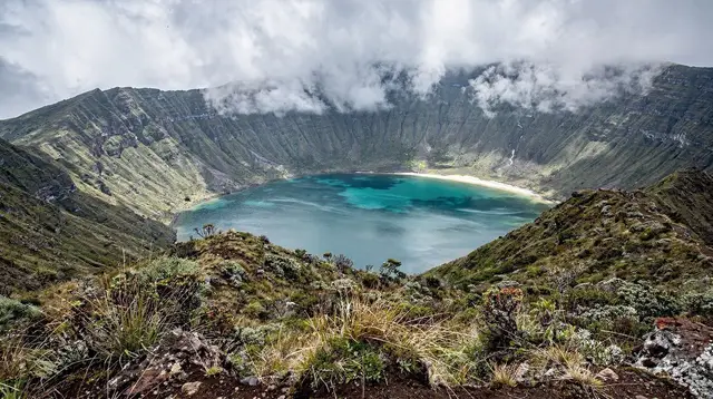
The west groups naturally around the Sete Cidades caldera, with its twin lakes seen from Vista do Rei, and extends out to Mosteiros on the coast and the tidal hot spring at Ponta da Ferraria.
These three sit close enough together that a single day covers the caldera in the morning, works down toward the coast by early afternoon, and reaches Ponta da Ferraria in time for a low-tide window — the spring is only usable around low tide, so the order matters as much as the route. A half-day from Ponta Delgada covers the caldera alone if that’s all the time you have; a full day lets you add the coast without retracing the same road twice.
a guided run through the Sete Cidades caldera paired with a stop at a pineapple greenhouse covers this west-side cluster in one sitting if you’d rather not self-drive the caldera roads, which switch back sharply on the descent to the lakes.
Building an East Day: Furnas Together With Nordeste
Furnas and Nordeste share the eastern arm of the island, and treating them as one connected day rather than two separate trips is where zone-based planning saves the most driving. A workable order starts in Furnas itself — the caldeiras, the Terra Nostra pool, a look at where cozido is buried to cook — before continuing along the coast road into Nordeste for its viewpoints and the laurel forest trail toward Pico da Vara. Doing it the other way around works too; what matters is that both zones sit on the same side of the island and can be strung together without cutting back through the center.
A Furnas day trip built around cozido and the thermal park and a Nordeste coastal day each stand alone if you’d rather split the two zones over separate days — reasonable if you want unhurried time in Furnas’ gardens and pools rather than a single long circuit. For travelers short on time who still want both, a day tour through the Furnas caldera with a tea-plantation stop and lunch included covers the western half of that eastern arm without you needing to plan the route yourself.
The North Coast: A Day of Its Own, or a Corridor Between Two Zones
The north coast, running from Ribeira Grande through the tea fields toward Nordeste, works two different ways depending on how the rest of the trip is shaped. Used as a destination in its own right, it gives a day built around the Caldeira Velha thermal waterfall, the Gorreana tea plantation, and the surf beach at Praia de Santa Bárbara — see the Ribeira Grande and Caldeira Velha day trip for how that fits together. Used as a corridor, the same stretch of road becomes the link between a west-side day and an east-side one, letting you pass through Gorreana or Caldeira Velha as a stop rather than a full stop-in destination.
Either approach avoids the real mistake, which is treating the north coast as a side errand tacked onto a day that’s already anchored somewhere else entirely — a stop at Caldeira Velha only makes sense if it sits along the route you’re already driving that day, not as a detour off it.
The Center: Lagoa do Fogo Needs a Weather Window, Not a Time Slot
Lagoa do Fogo sits in the middle of the island with no café, no ticket office, and no facilities of any kind, and it is frequently sitting inside cloud rather than offering the crater-lake view it’s known for. Because of that, it doesn’t work well as the anchor of its own day — there simply isn’t enough at the lake itself to fill one, and there’s a real chance you arrive to fog with nothing to show for the climb.
It works better folded into a day that already has another destination, most naturally a north coast day or a run toward Furnas, with a short detour up to the viewpoint if the road is open and the cloud has lifted. The day-trip guide to Lagoa do Fogo covers what to actually expect at the top, cloud included.
The South Coast: Folding It Into a West or East Day
Vila Franca do Campo, Caloura, and the south coast generally sit close enough to Ponta Delgada that they slot easily onto either end of a west-day or an east-day loop, rather than needing a dedicated day of their own on most itineraries. Vila Franca — the island’s capital until an earthquake-triggered landslide buried it in 1522 — makes a natural stop on the way back from Furnas, since the two are connected by road across the ridge without a detour through the capital.
A Vila Franca do Campo day trip lays out the town and its sunken-crater islet on their own if you want to give the south coast more room. Caloura’s small harbour and the villages of Lagoa and Água de Pau sit along that same stretch, close enough to slot into whichever loop already passes nearby rather than needing a day of their own.
Matching a Zone Plan to Your Trip Length
How many zones fit depends entirely on how many days are available, and that’s worth deciding before assigning specific attractions to specific days. A short trip of two or three days can realistically cover two zones well — typically Ponta Delgada plus the west, or Ponta Delgada plus the east — rather than rushing through four. A classic three-day itinerary shows what that looks like in practice: enough time to see Sete Cidades or Furnas properly, without also trying to fit the north coast or Nordeste into the same trip.
Longer trips change the math. Five days or more start to make all of the zones above workable without doubling back, because there’s enough slack to let a weather-dependent stop like Lagoa do Fogo wait for a clear morning instead of forcing it into a fixed slot. A seven-day itinerary covering the whole island can give the south coast, the center, and Nordeste each their own half-day rather than folding them into busier zones, which is the difference between seeing a place and passing through it.
The Mistake to Avoid: Never Fold In a Second Island
One error shows up more than any other in itinerary plans that try to do too much: adding a day trip to a different Azorean island — Terceira, Pico, São Jorge — onto a São Miguel-based schedule as though it were just another zone on the same map. It isn’t. Reaching another island means a flight or a long seasonal ferry, and there is no way to visit one, see anything worthwhile, and return the same day without losing the whole day to transit. Keep every zone-based day plan confined to São Miguel itself; treat another island, if you want one, as its own separate trip with its own arrival and departure, not a slot inside this one.
A smaller version of the same mistake happens inside a single zone too — trying to stack four or five stops into one west day, say, when three would let you actually linger at Ponta da Ferraria for the low-tide window instead of watching the clock. Zone-based planning fixes the problem of crossing the island too often; leaving room inside each zone once you’re there fixes the rest.
A Sample Skeleton: Four Zones, Four Days
| Day | Zone | Anchors | Notes |
|---|---|---|---|
| 1 | Ponta Delgada + arrival | Old town, Portas do Mar, Mercado da Graça | Easy day after flying in |
| 2 | West | Sete Cidades caldera, Mosteiros, Ponta da Ferraria | Time the hot spring around low tide |
| 3 | North coast + center | Ribeira Grande, Caldeira Velha, Gorreana, Lagoa do Fogo if clear | Weather-dependent last stop |
| 4 | East | Furnas caldera and thermal park, then Nordeste coast road | Book Furnas restaurants ahead |
This is a skeleton, not a fixed plan — it says nothing about how many days the whole trip should run or which town to base yourself in, both worth working out separately (see how many days you actually need and choosing between Ponta Delgada and Furnas as a base). What it shows is the shape: each day stays inside one zone, the order moves in one direction across the island rather than back and forth, and the center only appears when the weather and the day’s route both allow it.
Where Structure Meets Booking
Zone-based planning also decides what needs booking ahead. A Furnas day depends on a cozido order placed with a restaurant in advance, since the underground ovens aren’t something you can walk up and use. A day built around the caldera roads in the west benefits from a car booked early in high season.
Thermal pools and boat-based activities carry a version of the same logic. A whale-watching morning depends on sea conditions decided on the day itself, not weeks ahead, so it pays to keep some flexibility around which day of a trip it lands on rather than locking it into one fixed slot. None of that changes which zone a given day belongs to — it only changes how far in advance each piece of that day needs to be settled.
And if self-driving the switchback roads to Sete Cidades or across the island’s spine isn’t appealing, a guided option removes that part of the planning entirely: a private half-day jeep tour built around whichever zone you want to prioritize can be shaped to match a single cluster rather than a fixed route, and a full-island jeep tour covers several zones in one guided outing for travelers who’d rather not drive the island’s narrower roads themselves.
However the days end up assigned, the underlying logic stays the same: figure out which attractions share a corner of the island, keep each day inside one of those corners, and let the EN1-1A and via rápida do the connecting between them rather than crossing back and forth across the same ground more than once.
Planning on GetYourGuide
Verified deep-linked GetYourGuide tours. Book through these links and we earn a small commission at no cost to you.
GetYourGuide does not provide a product photo for this activity — the image shows the meeting point, photographed by us.