Vila Franca do Campo: The Coastal Walk to Nossa Senhora da Paz
What is the coastal walk to Nossa Senhora da Paz in Vila Franca do Campo?
It is a paved path and stairway climbing from Vila Franca do Campo to the whitewashed Nossa Senhora da Paz chapel, roughly 25-40 minutes each way, with views down over the town, the harbour and the Ilhéu de Vila Franca. It is a walk to a viewpoint, not a route out to the islet itself, which is reached only by boat, only in season, and never in rough sea.
A Chapel Above the Water
Vila Franca do Campo sits at sea level, tucked between the ridge behind it and the sunken crater islet just offshore, and the town’s best view of both is not from a boat but from a set of legs. A paved lane and stairway climbs out of the streets to the small whitewashed chapel of Nossa Senhora da Paz, perched on the cliff above the harbour. From up there the whole picture resolves at once: the grid of red roofs below, the curve of the seafront, and, a short swim’s distance beyond it, the ring of dark rock that is the Ilhéu de Vila Franca.
This is a walk to a viewpoint, not a walk to the islet. The two are easy to conflate because they share a horizon, but they are entirely different undertakings: one is a land route anyone reasonably fit can do on their own two feet, any day of the year in normal weather; the other is a sea crossing that only runs in season, only when conditions allow, and only with a boat.
This guide covers the former — the coastal climb to the chapel and back — and is deliberately narrow. It does not attempt to be a full day plan for the town and harbour (that is covered separately in the Vila Franca do Campo day trip guide), and it stays out of Caloura, the next harbour along the coast to the west, which has its own walking and swimming character worth a separate visit.
Why Vila Franca Sits Where It Does
The town below the chapel was not always the modest fishing and marina town it is today. Vila Franca do Campo was the capital of São Miguel until 1522, when an earthquake-triggered landslide buried much of it and the seat of the island’s administration moved to Ponta Delgada, where it has stayed ever since.
Walking the ridge above the old capital, with the harbour and the crater islet laid out below, it’s worth remembering that this stretch of coast has form for sudden, violent geology — the same volcanic ground that built the islet also, on one occasion, took the town apart. Nothing about the present-day walk is precarious, but the backstory explains why this small town carries an outsized history, covered in more depth in the former-capital guide.
The Ilhéu de Vila Franca, Seen From Above
The islet itself is the reason most visitors end up on this walk in the first place: it is one of the most photographed shapes on the south coast, a near-perfect ring of eroded crater rim enclosing a shallow, sheltered pool of sea. It is a nature reserve, with a capped number of daily visitors and no permanent buildings on it. Reaching it means a short boat crossing from the Vila Franca marina, and that crossing runs in season only, stopping outright whenever the sea is too rough to land safely.
There is no wading or swimming across from the mainland, and no path down to it from the chapel side — the cliffs make that impossible even if it were allowed. The full detail on tides, timing and the visitor cap is in the islet boat trip guide; the point worth carrying into this walk is simpler: what you see from Nossa Senhora da Paz is the whole of the islet from outside, and for a lot of visitors that view — free, unhurried, available every day of the year — is worth the climb on its own, independent of whether a boat is running that week.
The Route Up
The walk starts in central Vila Franca do Campo, close to the seafront and the small marina where the islet boats leave from. From there, signed paved lanes and a stairway climb steadily out of the town and up the cliff face. The gradient is real — this is a genuine uphill climb, not a stroll — but it is broken into manageable sections, with the stairway doing most of the height gain and a few flatter stretches to recover on. Most people cover it in 25 to 40 minutes, depending on pace, fitness and how often they stop to look back at the view, which improves with every switchback. There is some shade lower down among garden walls and trees; the upper stretches, closer to the chapel, are more exposed to sun and wind.
The surface throughout is paved stone rather than dirt trail, which makes the walk approachable in ordinary shoes but genuinely slick when wet — grippy, closed footwear is worth the trouble over sandals, especially outside the dry summer months. Handrails cover the steeper stair sections. There is no technical difficulty and no exposure to a drop that requires scrambling, but it is still a real hill climb in open air, not a level promenade, and it does not suit strollers, wheelchairs or anyone unsteady on uneven ground.
At the top, the chapel of Nossa Senhora da Paz is small, plain and usually quiet outside of local festival days. The real destination is the terrace and viewpoint around it: from here the town, the harbour, the coast running east toward Ribeira Quente and Furnas beyond it, and the full ring of the islet are all visible in one sweep. On a clear day the view carries a long way along the coast; on a hazier one, the shapes are softer but the islet’s ring is still unmistakable.
Combining the Walk With the Boat Trip
Because the chapel walk and the islet crossing share the same starting point — the Vila Franca marina area — a fair number of visitors do both in the same visit, seeing the islet from above first and then, weather and booking allowing, landing on it by boat afterward. That order works well: the climb gives context and orientation that makes the boat trip more legible once you’re on the water looking back at the cliff you just stood on.
If a boat crossing is part of the plan, book it ahead rather than assuming a same-day spot, particularly from June through September when demand is highest against the islet’s fixed daily cap. A private option such as the private boat tour around the islet and coast or the standard islet boat tour to the Ilhéu de Vila Franca both leave from the same marina the walk starts and ends at, so a morning climb followed by an afternoon crossing is a realistic single-day sequence rather than two separate trips.
For a longer stay in the area that folds the walk into a broader look at the town, port and coastline, the half-day tour of Vila Franca do Campo covers more ground without requiring you to plan the logistics yourself. None of these bookings are required for the walk itself, which needs no ticket, guide or reservation — they matter only if the islet crossing is also on the agenda.
Weather, Season and Getting the Timing Right
The chapel walk itself is a year-round activity. Unlike the islet boat, which stops running outside the warmer months and cancels on short notice whenever the sea turns, the coastal path to Nossa Senhora da Paz stays open and walkable through the wetter, windier months from November to March, weather on the day allowing.
It is worth being honest about what “weather on the day allowing” means on this island: São Miguel’s weather changes hour by hour and side by side, and a clear morning in Vila Franca do Campo says nothing certain about conditions by afternoon, or about what’s happening along the coast at Furnas or Nordeste at the same moment. Heavy rain makes the paved stairway genuinely slippery, and strong wind is more noticeable on the exposed clifftop near the chapel than it is down in the sheltered streets of the town — check the forecast for the morning of the walk rather than planning purely by season.
For the view itself, early morning and the couple of hours before sunset tend to give the clearest light and the most flattering angle on the islet’s ring and the coastline running east and west from it. For photography specifically, this stretch of coast is one of a handful the island’s better viewpoints are drawn from, covered together in the sunset viewpoints guide; an itinerary built specifically around light and viewpoints across several days is outlined in the photography and viewpoints route.
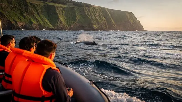
If whale watching is also part of the trip, it’s worth knowing this stretch of coast is one of the departure points used for trips out toward deeper water where sperm whales and dolphins are resident year-round and where migrating baleen whales pass in spring.
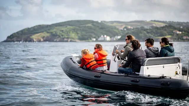
A guided option such as the whale and dolphin watching trip around Vila Franca and the islet combines the same waters visible from the chapel with a longer run out to open sea, though as with every boat trip on this coast, sightings are never guaranteed and departures depend on conditions — the general pattern for the island is set out in the whale watching overview, and the cancellation logic that applies to every boat leaving this marina, islet crossings included, is explained in full in the boat trips and weather guide.
What This Walk Is Not
It’s worth being precise about scope, because it’s easy to arrive expecting more than the walk delivers. This is not a route to the islet, and no path connects the chapel to it — the crossing exists only by boat, only in season, and never in a rough sea, full stop, regardless of how calm the water looks from the clifftop. It is not a hike into wilderness either: the path is paved, signed and close to town throughout, closer in character to a steep public stairway than to a backcountry trail. And it is not a substitute for a fuller look at Vila Franca do Campo’s town, harbour and history, which deserves its own visit and its own guide rather than being squeezed onto the end of a climb.
It is also not a ferry crossing to anywhere beyond São Miguel. There is no scheduled boat service linking this coast to the other islands of the archipelago — inter-island travel from here means flying, and the practicalities of that, along with why nothing resembling a mainland-style ferry exists in the Azores, are covered in the no-ferry explainer.
Practical Notes
Start from central Vila Franca do Campo, near the seafront and marina — the things to do in Vila Franca do Campo page has the broader lay of the town if you’re arriving without a fixed plan. Street parking is available around the centre but tightens in the middle of the day during peak summer weeks, so an early start solves two problems at once: easier parking and softer light at the top. Wear closed, grippy shoes rather than sandals — the paved surface is fine dry but slick when wet — and carry water, sun protection and a light layer for the wind on the exposed upper stretches, even on a warm day down at sea level.
Combine the climb with a coastal look at the water below rather than just the town: the same shoreline that fronts Vila Franca is also used for sea kayaking that traces the cliffs toward Caloura, detailed in the south coast kayaking guide, and for snorkeling in the sheltered pockets closer to Caloura’s harbour, covered in the Caloura snorkeling guide — neither is part of this walk, but both share the same stretch of coast and are easy to fold into the same day.
Divers looking specifically at the water inside the islet’s crater ring, rather than the walk above it, will find that covered separately in the island’s diving and water temperature overview.
For visitors weighing the two experiences against each other — walk versus boat, view from above versus landing on the islet — the honest answer is that they’re not really competing options. The walk is free, unbooked, open every day of the year, and gives the single best framed view of the islet that exists anywhere on this coast. The boat trip gets you inside the ring, into water most visitors never otherwise reach, but only when the season and the sea agree. Doing both, in that order, is the fullest way to understand why this small stretch of coastline — once the capital of the whole island — still draws a disproportionate amount of attention today.
Whale Watching on GetYourGuide
Verified deep-linked GetYourGuide tours. Book through these links and we earn a small commission at no cost to you.
GetYourGuide does not provide a product photo for this activity — the image shows the meeting point, photographed by us.